
Menznau
| Menznau | |
|---|---|
 |
|
| State : |
|
| Canton : |
|
| Constituency : | Willisau |
| BFS no. : | 1136 |
| Postal code : | 6122 Menznau 6123 Geiss 6125 Menzberg |
| UN / LOCODE : | CH MZU |
| Coordinates : | 645 624 / 214876 |
| Height : | 592 m above sea level M. |
| Height range : | 558–1110 m above sea level M. |
| Area : | 30.34 km² |
| Residents: | 2879 (December 31, 2018) |
| Population density : | 95 inhabitants per km² |
|
Proportion of foreigners : (residents without citizenship ) |
9.3% (December 31, 2,015) |
| Website: | www.menznau.ch |
 View of Menznau |
|
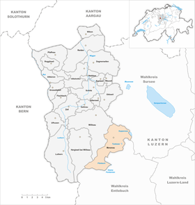
| Location of the municipality | |
  |
|
Menznau is a municipality in the Willisau constituency in the canton of Lucerne in Switzerland .
geography
Menznau is the southeasternmost municipality of the Willisau office and lies between Wolhusen and Willisau . Menznau borders on Buttisholz , Grosswangen , Hergiswil bei Willisau , Romoos , Ruswil , Willisau and Wolhusen. With an area of over 30 km², it is one of the larger towns in the canton of Lucerne. 59.3% of the community area is used for agriculture. Another 34.7% is covered with forest or wood and only 5.4% is settlement area. The church has two faces. To the west and south of the village of Menznau it consists of a rugged, heavily wooded hilly landscape - while to the east and north of it it comprises a cleared plateau. Between these extremes lies a narrow valley through which the Seewag flows. The southern boundary of the municipality is formed by the Krachenbach and the Kleine Fontanne .
Municipal boundary
From Waldighüsli (8 km southwest of Menznau-Dorf) on the Krachenbach, the municipal boundary leads in a north-easterly direction to Kaltenegg ( 1040 m above sea level ) west of Menzberg - and then always along the Menzberg-Twerenegg-Menznau road to Niespel (1, 9 km southwest of the village), where it takes a northerly direction up to Badhuet (2.4 km north-northwest of the village). There it turns to the east and forms the northern boundary of the community. At the hamlet of Tambach (3 km northeast of the village; 597 m above sea level ) on the northeast slope of the Geissberg , it turns southeast to the Soppensee . From the Soppensee the municipal boundary changes briefly to the south, then it flows with the (Great) Schwarzenbach briefly to the northwest - and then finally turns south. It reaches the Wolhuser Wigger near Wolhusen-Bad and follows its course to its source. After a few meters west, it leads south to the Flühbach . It follows its course in the direction of flow to the confluence of the Flühbach and Kleiner Fontanne. Finally, the municipality boundary follows the course of the Kleine Fontanne upstream to Waldighüsli.

Districts, hamlets & homesteads
The community consists of several districts and a number of hamlets and farms. Menznau-Dorf is 4 kilometers northwest of Wolhusen in the Seewag valley . The district of Geiss (1.7 km northeast of the village; 616 m above sea level ), which is located on the southwest slope of the Geissberg, belongs to the community . The Twerenegg district is located in the hill country, 3.5 kilometers southwest of the village at 910 m above sea level. M. on the road to Menzberg . This place is the largest settlement in the municipality after the village and is 7 kilometers southwest of the village at 1016 m above sea level. M.
The largest hamlets are Elsnau (600 m north-west of the village; 610 m above sea level ), Elswil (2 km north-east of the village; 600 m above sea level ) near Geiss, Tutensee (1.5 km south-east; 618 m above sea level). M. ) with the Tutensee of the same name (called Tuetenseeli), the scattered settlement Rengg (6 km south; 916 m above sea level ) between the Flühbach and the Kleine Fontannen, Rötelberg (1.6 km northwest; 612 m above sea level ) , Seehof (3.7 km northeast; 602 m above sea level ) on the northwest bank of the Soppensee and Blochwil (1.6 km north; 576 m above sea level ).
Waters
There are numerous streams in the municipality. In addition to the streams mentioned above, these are the Burgackerbach and the (Kleine) Schwarzenbach , which flow into the Tutensee. The (Grosse) Schwarzenbach flows through Geiss and the Ruswiler Rotbach through Blochwil. And the Rickenbach flows into the Seewag in Menznau-Dorf.
population
| Population development | |
|---|---|
| year | Residents |
| 1798 | 1'906 |
| 1850 | 2,337 |
| 1860 | 2,164 |
| 1870 | 2,206 |
| 1900 | 1'906 |
| 1920 | 2,327 |
| 1980 | 2,248 |
| 2000 | 2,850 |
| 2004 | 2,734 |
| 2009 | 2,860 |
From 1798 to 1850 the population rose sharply (1798–1850: + 22.6%). With the exception of the decade between 1860 and 1870, the population fell sharply due to rural exodus to the industrial areas (1850–1900: −18.4%). Within two decades, it grew again to the level of 1850 (1900–1920: + 22.1%). From 1920 to 1980 there was an up and down (1920–1980 in total: −3.4%). Then the number of residents increased by leaps and bounds within 20 years (1980–2000: +26.8%). The year 2000 was the year with the highest population figure ever recorded. Since then, the community has been losing population again (2000–2004: −4.1%).
languages
The population uses a highly Alemannic dialect as their everyday language. In the last census in 2000, 94.04% gave German, 2.95% Albanian and 1.33% Serbo-Croatian as their main language.
Religions - denominations

In the past, all residents were members of the Roman Catholic Church. This has changed as a result of leaving the church and immigration from other regions in Switzerland and abroad. Today (as of 2000) the religious landscape looks like this. There are 83.82% Roman Catholic and 7.44% Evangelical Reformed Christians. There are also 2.25% Muslims and 1.65% non-denominational. A quota of 4.00%, which is high for a rural community, refused to provide information on religious affiliation.
Origin - nationality
At the end of 2014, 2,648 of the 2,918 inhabitants were Swiss and 270 (= 9.3%) were foreigners. The population consisted of 90.7% Swiss citizens. At the end of 2014, the foreign residents came from Serbia including Kosovo (26.3%), Germany (25.6%), Portugal (10.4%), Italy (3.7%), Spain (0.7%) and the Turkey (0.7%). 16.7% came from the rest of Europe and 15.9 % came from outside Europe.
history

Around 1100 the Meierhof von Menznau came from Count Fenis-Hasenburg to the Benedictine monastery of St. Johann in Erlach on Lake Biel . These ownership rights to Menzenowa was from Pope Lucius III. Confirmed in a protective letter to the monastery in 1185 . The church and parish were probably founded in the 13th century by the barons of Hasenburg (Willisau). Around 1320 the castle site Kasteln and the patronage of the church and the lower rights were transferred to the Teutonic Order House Hitzkirch . After the repeal of the Kommende Hitzkirch in 1803, Lucerne took over the rights. From 1798 to 1803 Menznau belonged to the Ruswil district; then until 1814 to the office of Entlebuch . From 1814 it belonged to the Sursee office and only since 1831 to the Willisau office .
politics
Municipal council
The Menznau municipal council consists of five members and is set up as follows:
- Adrian J. Duss-Kiener: Mayor
- Beat Blum-Brunner: Mayor
- Helen Schurtenberger-Häfliger: Social Director
- Stefan Roos-Bannwart
- Bruno Emmenegger-Wüest
Cantonal elections
In the 2015 Cantonal Council elections for the Canton of Lucerne, the share of the vote in Menznau was: CVP 39.6%, SVP 30.2%, FDP 24.6%, GPS 3.0%, SP 1.7%, glp 0.8%.
National Council elections
In the Swiss parliamentary elections in 2015, the share of the vote in Menznau was: CVP 37.0%, SVP 30.5%, FDP 24.2%, SP 2.7%, Greens 2.0%, glp 1.8%, BDP 0, 8th %.
traffic
Menznau is on the Wolhusen-Langenthal railway line. Geiss and Menzberg are connected to public transport by a post bus line. Menznau is on the main road Wolhusen - Willisau - Dagmersellen. The closest motorway connections to the A2 are in a north-easterly direction at a distance of 15 km in Sursee and 17 km in a north-facing direction in Dagmersellen .
Attractions
photos

Menznau

railway station

Parish church

Local government

Primary school building

Secondary school house

Rickenhalle, multi-purpose facility


Web links
- Official website of the municipality of Menznau
- Community profile of the cantonal statistical office (PDF; 117 kB)
- Waltraud Hörsch: Menznau. In: Historical Lexicon of Switzerland .
- Waltraud Hörsch: Menzberg. In: Historical Lexicon of Switzerland .
- Waltraud Hörsch: Geiss. In: Historical Lexicon of Switzerland .
Individual evidence
- ↑ Permanent and non-permanent resident population by year, canton, district, municipality, population type and gender (permanent resident population). In: bfs. admin.ch . Federal Statistical Office (FSO), August 31, 2019, accessed on December 22, 2019 .
- ↑ Permanent resident population according to nationality category, gender and municipality ( memento of the original from January 1, 2015 in the Internet Archive ) Info: The archive link was inserted automatically and has not yet been checked. Please check the original and archive link according to the instructions and then remove this notice. (Permanent resident population)
- ↑ Balance of the permanent resident population according to demographic components, institutional structure, nationality and gender (Federal Statistical Office, STAT-TAB)
- ↑ LUSTAT: Community profile Menznau ( Memento of the original from May 8, 2016 in the Internet Archive ) Info: The archive link has been inserted automatically and has not yet been checked. Please check the original and archive link according to the instructions and then remove this notice.
- ↑ LUSTAT: Community profile Menznau ( Memento of the original from May 8, 2016 in the Internet Archive ) Info: The archive link has been inserted automatically and has not yet been checked. Please check the original and archive link according to the instructions and then remove this notice.
- ↑ National Council elections 2015: strength of the parties and voter turnout by municipality. In: Results of the National Council elections 2015. Federal Statistical Office, 2016, accessed on June 3, 2016 .
Alberswil | Altbüron | Altishofen | Dagmersellen | Egolzwil | Ettiswil | Fischbach | Gettnau | Grossdietwil | Hergiswil near Willisau | Luther | Menznau | Nebikon | Pfaffnau | Reiden | Roggliswil | Schötz | Ufhusen | Wauwil | Wikon | Willisau | Cell
Former parishes: Buchs | Boar corners | Kottwil | Langnau near Reiden | Ohmstal | Richenthal | Uffikon | Willisau Land | Willisau city
Canton of Lucerne | Constituencies of the Canton of Lucerne | Municipalities of the Canton of Lucerne