
Reiden
| Reiden | |
|---|---|
 |
|
| State : |
|
| Canton : |
|
| Constituency : | Willisau |
| BFS no. : | 1140 |
| Postal code : | 6260 Reiden 6262 Langnau b. Reiden 6263 Richenthal |
| UN / LOCODE : | CH REI |
| Coordinates : | 640 105 / 232626 |
| Height : | 457 m above sea level M. |
| Height range : | 446–718 m above sea level M. |
| Area : | 27.03 km² |
| Residents: | 7132 (December 31, 2018) |
| Population density : | 264 inhabitants per km² |
|
Proportion of foreigners : (residents without citizenship ) |
22.7% (December 31, 2,015) |
| Website: | www.reiden.ch |
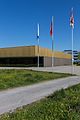
 View in south direction from the coming |
|
| Location of the municipality | |
  |
|
Reiden is a municipality in the Willisau constituency in the canton of Lucerne in Switzerland .
On January 1, 2006, the old community of Reiden (3,980 inhabitants, 11.28 km²) merged with the communities of Langnau bei Reiden and Richenthal to form the new community of Reiden .
geography

Reiden is a place in the lower Wiggertal and lies east of the Wigger on the canton border with the canton of Aargau . The village has grown rapidly in recent decades and now also includes the former hamlets and farms of Unterdorf , Bifang , Unterwasser , Sonnhalden , Hinterberg and Oberdorf . The partly wooded Hochfluh ( 559 m above sea level ) rises south of the village . To the east of the village lies the Lausberg ( 632 m above sea level ). And the connecting piece between these two heights is the Ehag ( 682 m above sea level ), which is almost entirely covered by the Sertel Forest . The second largest settlement in the municipality is Reidermoos ( 490 m above sea level ), 1.4 km north-northeast of the village, which has grown together with the hamlet of Klempen ( 500 m above sea level ) to the north of it . North of these two districts is the heavily forested Klempenberg , which has a maximum height of 651 m above sea level. M. achieved. Otherwise there are only groups of houses and individual farmsteads in the municipality.
The southern border leads from the Wigger over the Ehag to the Uerke further east. This Grenzbach also forms the eastern border of the municipality. At Moosersagi (municipality of Wikon) the municipal boundary leaves the Uerke, turns west and leads over the Klempenberg, the Fuchshubel ( 656 m above sea level ) and the Birchberg ( 629 m above sea level ) to the northwest of this, back to the Wigger . This partially forms the western border.
Most of the community area east of Reidermoos consists of various forest areas. The largest apart from those already mentioned are the fir forest and the beech forest in the east of the municipality. It is therefore not surprising that 40.1% of the municipal area is covered by forest and wood. The flat area around Reiden and Reidermoos is either used for agriculture (47.3%) or is settlement area (12.1%).
For the parts of the community in the area of the former communities of Richenthal and Langnau bei Reiden, see the description there.
Reiden borders on Altishofen , Dagmersellen , Grossdietwil , Pfaffnau , Triengen and Wikon in the canton of Lucerne, as well as on the Aargau communities of Brittnau and Reitnau .
population
| Population development | |
|---|---|
| year | Residents |
| 1798 | 1,100 |
| 1850 | 1,685 |
| 1870 | 1,637 |
| 1888 | 1,437 |
| 1960 | 2,795 |
| 1970 | 3,275 |
| 1980 | 3,363 |
| 1990 | 3,770 |
| 2000 | 4,090 |
| 2004 | 3,980 |
| 2008 | 6,336 |
| 2011 | 6,595 |
| 2014 | 6,813 |
| 2015 | 6,867 |
The number of residents rose by around half between 1798 and 1850 (1798–1850: +53.2%). From 1870 to 1888 Reiden was also affected by the rural exodus (1870–1888: −12.2%). Then the population grew, apart from the stagnation phases 1910–1920, 1941–1950 and 1970–1980, continuously until 2000. Between 1888 and 1960 the population doubled; in the following forty years again by around half. It has stagnated ever since.
languages
The population uses a highly Alemannic dialect as their everyday language. In the last census in 2000, 84.23% said German, 6.04% Albanian and 3.47% Italian were the main languages.
Religions - denominations
In the past, all residents were members of the Roman Catholic Church. This has changed as a result of leaving the church and immigration from other regions in Switzerland and abroad. In 2000, the religious composition of the population was as follows: There were 65.1% Roman Catholic, 16.8% Protestant Reformed and 2.30% Orthodox Christians. In addition, 8.1% were found Muslims and 10% who belonged to other religious communities or were non-denominational.
Origin - nationality
At the end of 2014, 5,387 of the 6,892 inhabitants were Swiss and 1,505 (= 21.8%) were foreigners. The population consisted of 78.2% Swiss citizens. At the end of 2014, the foreign residents came from Serbia including Kosovo (27.2%), Germany (14.5%), Portugal (13.8%), Italy (11.4%), Spain (2.4%) and the Turkey (1.5%). 22.5% came from the rest of Europe and 6.8 % came from outside Europe.
history


As finds from Roman times indicate, the community was probably settled back then. The place is first mentioned indirectly when a Walther von Reiden is mentioned in a deed of donation from Ulrich von Eschenbach from 1168. The place came under the rule of the Habsburgs early on and from then on belonged to their county of Willisau. In 1407 the city of Lucerne bought this county and until 1798 Reiden remained part of the Lucerne bailiff of Willisau. Until 1803 it belonged to the Altishofen district, then to the newly created office of Willisau . On January 1, 2006, the communities of Langnau bei Reiden , Richenthal and Reiden merged into one community.
politics
Municipal council
The Reiden municipal council consists of five members and is structured as follows:
- Hans Kunz ( CVP ): Mayor
- Bruno Aecherli (ig-reiden): Finances
- Bruno Geiser (SVP): Education
- Esther Steinmann-Neeser (ig-reiden): Social and society
- Willi Zürcher ( FDP ): Construction and Infrastructure
Cantonal elections
In the 2015 canton council elections for the canton of Lucerne, the share of the vote in Reiden was: CVP 32.1%, SVP 30.1%, FDP 25.7%, SP 7.4%, GPS 2.4%, glp 2.4%.
National Council elections
In the Swiss parliamentary elections 2015, the voter share in Reiden was: SVP 32.9%, CVP 25.9%, FDP 21.0%, SP 8.8%, glp 4.9%, Greens 3.2%, BDP 1, 6%.
traffic
Reiden is on the Lucerne – Olten railway line and has its own train station. The community is important as a junction between two bus routes operated by the Limmat Bus company . These are: Zofingen – Wikon – Reiden – Pfaffnau – Roggliswil – St. Urban and Zofingen – Wikon – Reiden – Richenthal.
Reiden is on the Lucerne-Sursee-Zofingen-Olten-Basel road, the so-called Baslerstrasse. The community has its own motorway connection 2 km from the village center.
Attractions
- Johanniter - Coming
- Aecherli Museum
- Langnau-Mehlsecken village museum

photos

Pestalozzi Schoolhouse

Cardinal Benno Gut Memorial
Johanniterhalle

reformed Church

Farmhouse
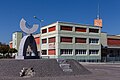
Roundabout, Mehlsecken commercial zone

swimming pool


Personalities
- Marianne Schroeder , composer and pianist
- Benno Gut , Benno Walter Cardinal Gut, honorary citizen of Reiden
- Hermann von Liebenau , doctor and historian, grew up in Reiden
- Huldrych Martin F. Koelbing (1923–2007), ophthalmologist and medical historian
Web links
- Official website of the municipality of Reiden
- Community profile of the cantonal statistical office (PDF; 111 kB)
- Waltraud Hörsch: Reiden (community). In: Historical Lexicon of Switzerland .
- Lucerne: Former Johanniter comers from Reiden on www.swisscastles.ch
- Johanniter Coming on www.reiden.hermannkeist.ch
Individual evidence
- ↑ Permanent and non-permanent resident population by year, canton, district, municipality, population type and gender (permanent resident population). In: bfs. admin.ch . Federal Statistical Office (FSO), August 31, 2019, accessed on December 22, 2019 .
- ↑ Permanent resident population according to nationality category, gender and municipality ( memento of the original from January 1, 2015 in the Internet Archive ) Info: The archive link was inserted automatically and has not yet been checked. Please check the original and archive link according to the instructions and then remove this notice. (Permanent resident population)
- ↑ Balance of the permanent resident population according to demographic components, institutional structure, nationality and gender (Federal Statistical Office, STAT-TAB)
- ↑ a b LUSTAT: Reiden community profile ( Memento of the original from May 8, 2016 in the Internet Archive ) Info: The archive link has been inserted automatically and has not yet been checked. Please check the original and archive link according to the instructions and then remove this notice.
- ↑ National Council elections 2015: strength of the parties and voter turnout by municipality. In: Results of the National Council elections 2015. Federal Statistical Office, 2016, accessed on June 3, 2016 .
- ↑ Website about the Johanniterkommende Reiden
- ^ Website of the Aecherli Museum
- ↑ Website on the Langnau-Mehlsecken village museum
Alberswil | Altbüron | Altishofen | Dagmersellen | Egolzwil | Ettiswil | Fischbach | Gettnau | Grossdietwil | Hergiswil near Willisau | Luther | Menznau | Nebikon | Pfaffnau | Reiden | Roggliswil | Schötz | Ufhusen | Wauwil | Wikon | Willisau | Cell
Former parishes: Buchs | Boar corners | Kottwil | Langnau near Reiden | Ohmstal | Richenthal | Uffikon | Willisau Land | Willisau city
Canton of Lucerne | Constituencies of the Canton of Lucerne | Municipalities of the Canton of Lucerne