St. Marie Peak
| St. Marie Peak | ||
|---|---|---|
|
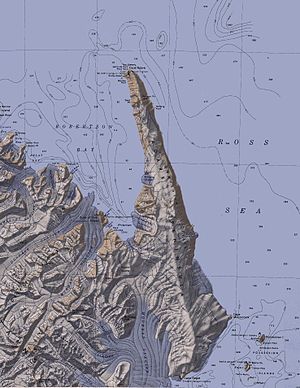
Topographic map of the Adare Peninsula and Foyn Island (bottom right) with St. Maire Peak |
||
| height | 100 m | |
| location | Foyn Island , Possession Islands , Ross Sea | |
| Coordinates | 71 ° 56 ′ 0 ″ S , 171 ° 5 ′ 0 ″ E | |
|
|
||
The St. Maire Peak is a 100 m high mountain in the East Antarctic Victoria Land . It rises at the north end of Foyn Island in the group of Possession Islands .
The United States Geological Survey mapped it based on its own surveys and aerial photographs of the United States Navy from 1958 to 1963. The Advisory Committee on Antarctic Names named it in 1969 after Lieutenant Commander John W. St. Marie, co-pilot on a flight of the Navy squadron VX-6 on January 18, 1958, during which the Possession Islands and this mountain were photographed.
Web links
- St. Maire Peak in the Geographic Names Information system of the United States Geological Survey (English)
- St. Maire Peak on geographic.org (English)

