Stone stool Point
| Stone stool Point | ||
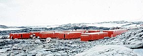
 The Wilkes Station on Stonehocker Point (1957) |
||
| Geographical location | ||
|
|
||
| Coordinates | 66 ° 15 ′ S , 110 ° 31 ′ E | |
| location | Wilkesland , East Antarctica | |
| coast | Budd coast | |
| Waters | Mawson Lake | |
| Waters 2 | Powell Cove | |
 Map of the northern Windmill Islands with Stonehocker Point (center) |
||
The Stone Stool Point is a rocky headland on the Budd Coast of the East Antarctic Wilke country . It forms the western foothills of the Clark Peninsula and is the location of the Wilkes Station, which was abandoned in 1969 .
The Wilkes station was built here in 1957 and was first used by a team led by the American polar explorer Carl R. Eklund (1909–1962). Eklund named the headland after the US ionospheric physicist Garth Hill Stonehocker (1925-1999), who was part of the winter team at Wilkes Station in 1957 during the International Geophysical Year .
Web links
- Stonehocker Point in the Geographic Names Information System of the United States Geological Survey (English)
- Stonehocker Point on geographic.org (English)
