Straufhain (mountain)
| Straufhain | ||
|---|---|---|
|
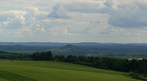
Straufhain from Hildburghausen Stadtberg |
||
| height | 449 m above sea level NN | |
| location | Thuringia ( Germany ) | |
| Mountains | Heldburger Land | |
| Coordinates | 50 ° 20 '23 " N , 10 ° 42' 55" E | |
|
|
||
| rock | basalt | |
| particularities | Straufhain castle ruins | |
At 449 meters, the Straufhain is the highest point in the Heldburger Land in Thuringia ( Germany ). At its summit are the ruins of the medieval Straufhain Castle .
The Straufhain is part of the Heldburger Gangschar , a volcanic chain from the Tertiary .
history
At the time of the division of Germany, access to the mountain was closed to the public for decades, it was militarily occupied by the border troops of the GDR . The inner border fence ran at the eastern foot of the mountain and that was where the infamous minefields lay. After German reunification, Heimatfreunde re-established access to Straufhain, marked hiking trails, and the mountain is once again a popular destination.
literature
- Norbert Klaus Fuchs: The Heldburger Land - a historical travel guide ; Rockstuhl Publishing House, Bad Langensalza 2013, ISBN 978-3-86777-349-2

