
Svyatoi Nos
| Svyatoi Nos | |
 Map of Lake Baikal |
|
| Geographical location | |
.svg) |
|
| Coordinates | 53 ° 40 ′ N , 108 ° 50 ′ E |
| Waters 1 | Baikal lake |
| Waters 2 | Barguzinskiy Zaliv |
| Waters 3 | Chivyrkuyskiy Zaliv |
| length | 54 km |
| width | 20.4 km |
| surface | 596 km² |
 Satellite image from NASA Geocover 2000 (with artifact ) |
|
Swjatoi Nos ( Russian Свято́й Нос , in German about "Holy Nose") is the largest peninsula in Lake Baikal .
geography
It is located in the Russian Republic of Buryatia and protrudes into the lake from the eastern bank. The peninsula is 54 km long and 20 km wide from Cape Verkhneje Izgolowje (about "Upper Head ") in the northeast to Cape Nizhneye Izgolowje ("Lower Head ") in the southwest. Their area is 596 km².
The peninsula belongs to the system of the Bargusing Mountains , which extends northeast of Lake Baikal, and rises to a height of 1898 meters (according to other sources 1877 meters). The largest place on the peninsula is the fishing and hunting village Kurbulik (Kurbylik) in the northeast. The relatively flat and marshy land bridge Cziwyrkujski , which connects the peninsula with the east coast of Lake Baikal, is 7.4 km wide at its narrowest point. Lake Arangatui lies on the isthmus . In the north of the isthmus is the shallow bay Chivyrkuyskiy Zaliv , in the south the larger and deep Barguzinskiy Zaliv , which demarcate the peninsula from the mainland.
administration
The peninsula belongs to the Barguzin district of the Republic of Buryatia.
natural reserve
The peninsula is part of the Transbaikal National Park (Sabaikalski National Park).
photos

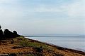
East coast of Lake Baikal with the Svyatoi Nos peninsula
The flat land bridge to the peninsula

The fishing village Kurbulik


