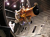
TacSat
With TacSat ( Tac tical Sat ellite ; German tactical satellite ) is a series of US satellites called, which was initiated by the "Office of Force Transformation" (OFT) of the American forces.
The TacSat program
The TacSat program , which was launched at the instigation of the US Air Force and the Pentagon Office of Force Transformation (OFT), was intended to close a gap in the military satellite sector. The previous satellite programs took a long time between project start and deployment, including long periods in orbit . They were also extremely costly.
This program should provide a number of standard satellites, which should cost a maximum of 15 million dollars including launch and are available within a few days, a maximum of one week, after the decision to launch. Due to the worldwide deployments of the US military and the extremely strong networking of the troops aimed at by the OFT, this is also absolutely necessary if the new combat doctrines are to be applied in short-term combat operations.
The individual satellites
TacSat 1
110 kg microsatellite with an infrared camera and a low-resolution color camera. TacSat 1 was built from redundant satellite structures from the Orbcomm program. TacSat 1 was scheduled to launch in 2007 with SpaceX's Falcon 1 rocket . Due to the delays in the launcher program, TacSat 2 was launched before TacSat 1, making it obsolete. A start is no longer planned.
TacSat 2
This satellite has a mass of 370 kg and is equipped with a high-resolution color camera from the Air Force Research Laboratory. The TacSat 2, also known as the Roadrunner , was launched on December 16, 2006 on a Minotaur-1 rocket from the Mid-Atlantic Regional Spaceport and placed in a near-Earth orbit of 370 km altitude. It burned up on February 5, 2011.
Other experimental payloads:
- Inertial Stellar Compass - star sensor , the part of the New Millennium Program of NASA has been developed as part of the ADCS system's satellite.
- High-resolution multi-spectral line scanner ( pushbroom ) with 6144 pixels and a swath of 5 km.
- SIGINT - software-defined radio receiver with eleven antennas, combined with a 50 cm telescope for the detection and localization of RF signal sources, including AIS and mobile radio signals .
- Secure data link with 274 Mbps (downlink) and 0.2 Mbps (uplink).
- FPGA -based fast image processing hardware.
- HET ion propulsion ; Data: 200 W, 12 mN, 0.1 x 0.1 x 0.1 m³, 1 kg.
- GPS receiver with its own ionospheric observation
- Unit for analyzing the atmosphere in orbit.
- Test unit for damping vibrations.
- low-cost thin-film solar cells.
- Computer unit for autonomous control of the satellite.
TacSat 3
This hyperspectral satellite was built in cooperation between the research laboratories of the US Air Force, the US Army and the US Navy for at least partially weather-independent reconnaissance. TacSat 3 launched on May 19, 2009 on a Minotaur-1 rocket and burned up on April 30, 2012.
TacSat 4
This communications satellite, which weighs 450 kg at the upper end of the TacSat line, was developed together with the National Reconnaissance Office and launched on September 27, 2011 with a Minotaur-4 . It is characterized by the extremely elliptical orbit (HEO, highly elliptical orbit), which, similar to the Russian Molnija satellites, offers a long contact time for the tactical forces in the target area. TacSat 4 is also listed as Com-X and is intended to serve as the basis for up to five other satellites that are identical in construction in the satellite bus.
Web links
swell
- ^ TacSat-2. The Aerospace Corporation, archived from the original on March 14, 2012 ; accessed on March 8, 2012 (English).
- ↑ TacSat ORS in the Encyclopedia Astronautica , accessed on 8 March 2012 (English).
- ↑ TacSat-2 Provides Testbed for New Navigation Sensor
- ^ TacSat-3 information. NASA, May 20, 2009, accessed August 3, 2009 .
- ↑ Aerospace: Tacsat 3. Archived from the original on May 9, 2015 ; accessed on January 15, 2015 .


