Taebaek Mountains
| Taebaek Mountains | ||
|---|---|---|
| Highest peak | Seoraksan ( 1708 m ) | |
| location | South Korea , North Korea | |
|
|
||
| Coordinates | 37 ° 45 ′ N , 128 ° 29 ′ E | |

|
|
| Korean spelling | |
|---|---|
| Korean alphabet : | 태백 산맥 |
| Hanja : | 太白 山脈 |
| Revised Romanization : | taebaek sanmaek |
| McCune-Reischauer : | t'aebaek sanmaek |
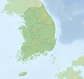
The Taebaek Mountains ( Kor. 태백 산맥 , Hanja 太白 山脈 , rev. Taebaek Sanmaek ) are the main mountain range of the Korean Peninsula .
It extends for about 500 km in a north-south direction parallel to the eastern coast. From the west it rises gradually from a coastal plain up to 100 kilometers wide, in the east it drops steeply to the coast of the Sea of Japan . The average height is around 1000 m.
The highest mountains are the Seoraksan (1708 m), the Kŭmgangsan (1638 m) and the Odaesan (1563 m). Both the Nakdonggang and the Hangang arise from the foothills of the mountains.
Taebaeksan National Park
The Taebaeksan National Park ( 태백산 국립 공원 ), founded in 2016, extends over part of the mountains , the highest peaks of which are the Taebaeksan ( 태백산 ) and Janggunbong ( 장군봉 ) peaks at 1567 m .
Picture gallery
Web links
- T'aebaek Mountains in the Encyclopædia Britannica (English)
- 태백 산맥 (太白 山脈) in the Doosan Encyclopedia (Korean)
Individual evidence
- ↑ Gangwon-do - Taebaek Mountain . Korea Forest Service , accessed November 22, 2018 .


