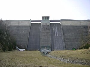
Křimov dam
| Křimov dam | |||||||||
|---|---|---|---|---|---|---|---|---|---|
| Dam wall | |||||||||
|
|||||||||
|
|
|||||||||
| Coordinates | 50 ° 29 '52 " N , 13 ° 18' 52" E | ||||||||
| Data on the structure | |||||||||
| Lock type: | Gravity dam | ||||||||
| Construction time: | 1953-1958 | ||||||||
| Height of the barrier structure : | 41.29 m | ||||||||
| Height of the structure crown: | 569 m above sea level NN | ||||||||
| Crown length: | 201.2 m | ||||||||
| Crown width: | 4 m | ||||||||
| Data on the reservoir | |||||||||
| Altitude (at congestion destination ) | 566 m above sea level NN | ||||||||
| Water surface | 10.4 ha | ||||||||
| Storage space | 1.48 million m³ | ||||||||
The Křimov Dam (Vodní nádrž Křimov) is a drinking water dam in the Bohemian Ore Mountains , Czech Republic.
It is located one kilometer northwest of Suchdol in the village of Křimov at 566 m above sea level. Dammed waters are the Křimovský potok and the Menhartický potok. The drainage water is the Křimovský potok, which flows into the Chomutovka on the right-hand side below the dam . Two kilometers to the northeast is the Kamenička Dam and eight kilometers to the southeast is the town of Chomutov (Komotau).
The dam was built between 1953 and 1958. The villages of Stráž and Menhartice to the west of the catchment area were dissolved in 1958. In 1959 the dam went into operation. The water area is 10.4 ha, the reservoir holds 1.48 million m³ of water. The wall has a height of 41.29 m. The top of the wall is 201.2 m long and 4 m wide.
The Chomutov – Vejprty / Reitzenhain railway runs south of the reservoir .

