Tautuku Peninsula
| Tautuku Peninsula | ||
 View across Tautuku Bay to the Tautuku Peninsula on the horizon |
||
| Geographical location | ||
|
|
||
| Coordinates | 46 ° 36 '16 " S , 169 ° 26' 14" E | |
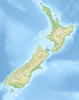
| location | On the Catlins , southeast coast of the South Island , Otago Region , New Zealand | |
| Waters 1 | Tautuku Bay, Pacific Ocean | |
| length | 1.6 km | |
| width | 1.7 km | |
The Tautuku Peninsula is a rocky peninsula on the south coast of New Zealand's South Island and a station on the Southern Scenic Route . It is located in the Catlins , 25 km east of Waikawa on the west end of Tautuku Bay . The peninsula is bounded to the east by the mouth of the Tautuku River . To the west of the cape is Lathyrus Bay .
In the 1830s and 1840s there was a whaling station near the base of the peninsula, and later a small port was built for fishing and the flax and timber industries. With the decline of these industries, the port was closed. Today there are numerous holiday homes ( cribs ) on the peninsula, some of which can only be reached with off-road vehicles due to the lack of roads. The Pratt Road connects the coastal road between Owaka and Fortrose with the base of the peninsula, and most of the houses are located in its vicinity. The closest settlement, Tautuku, is on this road .
literature
- New Zealand Travel Atlas , Wise Maps Auckland. ISBN 0-908794-47-9 .
