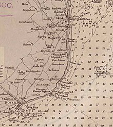
The Downs
As The Downs , a territory in the area of is the English Channel between the Goodwin Sands and the eastern Kent at the junction of the North Sea called in the English Channel.
The Downs are in front of the cities of Deal and Ramsgate . They are protected from the west by the mainland and from the east by the Goodwin Sands and are therefore traditionally a popular anchorage. From the 17th to the 20th century, the Downs served as an anchorage for the Royal Navy and as a gathering point for convoys during wartime .
To this day, however, Goodwin Sands, notorious since the Middle Ages as the “ swallower of shippes ” (German: “Schiffeverschlucker”), poses a considerable risk. During storms from the west-south-west / south-west, the downs repeatedly proved to be a trap for ships, as they were driven onto the Goodwin Sands by the wind. The worst of its kind occurred in 1703 in the so-called Great Storm , in which four Royal Navy ships of the line anchored in the Downs and an unknown number of merchant ships perished in the Goodwin Sands. In the sinking of the four liners alone, over 1,000 seamen died.
On October 21st Jul. / October 31, 1639 greg. the naval battle in the Downs took place during the Eighty Years' War between the fleet of the United Netherlands under Admiral Maarten Tromp and the Spanish-Portuguese fleet of Admiral Antonio de Oquendo .
Coordinates: 51 ° 11 ′ 0 ″ N , 1 ° 29 ′ 0 ″ E
