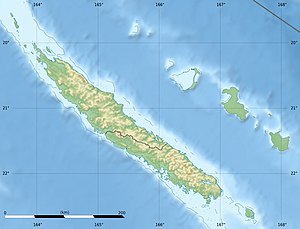
Tiga (New Caledonia)
| Tiga | ||
|---|---|---|
| LANDSAT picture (2000) | ||
| Waters | Coral sea | |
| Archipelago | Loyalty Islands | |
| Geographical location | 21 ° 6 '25 " S , 167 ° 48' 53" E | |
|
|
||
| length | 5.7 km | |
| width | 2.6 km | |
| surface | 10 km² | |
| Highest elevation | Lalawen 93 m |
|
| Residents | 169 (1996) 17 inhabitants / km² |
|
| main place | Toka | |
Tiga (or Tokanod ) is a New Caledonian island and one of the French Loyalty Islands . The island had 169 inhabitants in 1996 and 158 in 1989, and an area of 10 km². This recently resulted in a population density of 17 inhabitants per square kilometer.
geography
The island is located 150 km northeast of the main island of New Caledonia, Grande Terre , 34 km east of the upscale atoll Lifou and 26 km north of the island of Maré . Its highest point is 92 m.
administration
Tiga belongs to the municipality of Lifou and within it to the district coutumier (traditional district, chiefdom ) de Loessi .
history
The island was discovered around the year 700.

