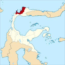
Toli-Toli (administrative district)
| Kabupaten Toli-Toli Toli-Toli administrative district
|
||
|---|---|---|
 |
||
| Symbols | ||
|
||
| Basic data | ||
| Country | Indonesia | |
| province | Sulawesi Tengah | |
| Seat | Toli-Toli | |
| surface | 4,079.6 km² | |
| Residents | 211,283 (2010) | |
| density | 52 inhabitants per km² | |
| ISO 3166-2 | ID-ST | |
| Website | www.tolitolikab.go.id (Indonesian) | |
| politics | ||
| Bupati | DR (hc). H. Moh. Saleh Bantilan, SH., MH | |
| Mountains with clove plantations in Toli-Toli | ||
Coordinates: 1 ° 2 ′ N , 120 ° 49 ′ E
Toli-Toli or Tolitoli is a government district ( Kabupaten ) on the Indonesian island of Sulawesi . The district is part of the Sulawesi Tengah Province ( Central Sulawesi ). 211,283 inhabitants live here (2010).
geography
Toli-Toli has an area of 4,079.6 km². The capital is the port city of Toli-Toli in the district ( Kecamatan ) Baolan.
Administrative division
The Toli-Toli district consists of 10 administrative districts ( Kecamatan ) and six Kelurahan (as of 2010):
| District | Population census 2010 |
|---|---|
| Dampal Selatan (South Dampal) |
21,394 |
| Dampal Utara (North Dampal) |
14,390 |
| Dondo | 21,358 |
| Ogodeide | 11,682 |
| Basidondo | 10,458 |
| Baolan | 63,072 |
| Lampasio | 11,875 |
| Galang | 31,701 |
| Tolitoli Utara (North Toli-Toli) |
16,940 |
| Dako Pamean | 8,426 |
Individual evidence
- ^ Biro Pusat Statistics, Jakarta, 2011.


