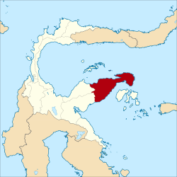
Banggai Governorate
| Kabupaten Banggai Banggai Governorate
|
||
|---|---|---|
 |
||
| Symbols | ||
|
||
| Basic data | ||
| Country | Indonesia | |
| province | Sulawesi Tengah | |
| Seat | Luwuk | |
| surface | 9,672.7 km² | |
| Residents | 323,872 (2010) | |
| density | 33 inhabitants per km² | |
| ISO 3166-2 | ID-ST | |
| Website | www.banggaikab.go.id (Indonesian) | |
| politics | ||
| Bupati | Muhammad Sofhian Mile SH, MH | |
Coordinates: 0 ° 57 ' S , 122 ° 47' E
Banggai is a government district ( Kabupaten ) on the Indonesian island of Sulawesi . The district is part of the Sulawesi Tengah Province ( Central Sulawesi ). 323,872 inhabitants live here (2010).
geography
Banggai has an area of 9,672.70 km². The capital is Luwuk .
Administrative division
The Banggai district consists of 18 administrative districts ( Kecamatan ), six Kelurahan and 187 villages (Desa) (as of 2010):
| District | Population census 2010 |
|---|---|
| Toili | 30,716 |
| Toili Barat (West Toili) |
20,708 |
| Moilong | 18.097 |
| Batui | 14,725 |
| Batui Selatan (South Batui) |
12,847 |
| Bunta | 18,277 |
| Nuhon | 17,886 |
| Simpang Raya | 13,589 |
| Kintom | 13,023 |
| Luwuk | 73.905 |
| Luwuk Timur (East Luwuk) |
10,557 |
| Pagimana | 20,790 |
| Bualemo | 16,968 |
| Lobu | 3,323 |
| Lamala | 12,510 |
| Masama | 10,517 |
| Balantak | 9,300 |
| Balantak Selatan (South Balantak) |
4,455 |
Individual evidence
- ^ Biro Pusat Statistics, Jakarta, 2011.

