Tongoa
| Tongoa (Kuwae) | ||
|---|---|---|
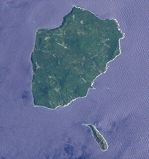
| NASA satellite image of Tongoa and Ewose (below) | ||
| Waters | Pacific Ocean | |
| Archipelago | Shepherd Islands | |
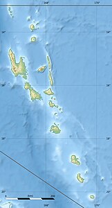
| Geographical location | 16 ° 54 ′ 0 ″ S , 168 ° 33 ′ 0 ″ E | |
|
|
||
| length | 9 km | |
| width | 6 km | |
| surface | 41 km² | |
| Highest elevation | Mount Mallamao 487 m |
|
| Residents | 2243 (2015) 55 inhabitants / km² |
|
| main place | Monua (Morua) | |
Tongoa is an island in the north of the Shepherd Islands in the South Pacific island state of Vanuatu . It belongs to the central Vanuatu province of Shefa .
With a land area of 41 km², the volcanic island , which is only sparsely populated in the coastal regions, is the largest of the Shepherd Islands. It also brings together most of the Shepherd Islands' population. It is 7 kilometers from the island of Épi , which is also part of the Shefa province, and around 70 kilometers from Éfaté (on which the Vanuatu capital Port Vila is located). In Tavani Akoma on the east side, the island reaches a height of 487 meters.
The 2243 inhabitants (2015 census) are spread over 14 villages. For the 2009 census, 2300 inhabitants were counted, in 1979 2856 inhabitants were counted and 2397 in 1999.
Two kilometers to the southwest is the uninhabited island of Ewose . About three kilometers northwest of Tongoa is the submarine volcano Kuwaé , which is considered one of the most active volcanoes in Vanuatu.
See also
literature
- Maëlle Calandra: Une horticulture maritime? Pratiques et perceptions de la mer à Tongoa (Vanuatu). Revue d'ethnoécologie, 2018
- Topographic map sheet 1: 100,000: Epi and Shepherd Islands, IGN 1964

