Shepherd Islands
| Shepherd Islands | ||
|---|---|---|
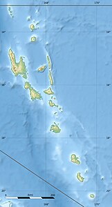
| Relief Map of the Shepherd Islands | ||
| Waters | Pacific Ocean | |
| archipelago | New Hebrides | |
| Geographical location | 16 ° 59 ′ S , 168 ° 28 ′ E | |
|
|
||
| Number of islands | 11 | |
| Main island | Tongoa | |
| Total land area | 89 km² | |
| Residents | 3271 (2015) | |
| Map of the Shepherd Islands | ||
The Shepherd Islands are a central group of islands in the South Pacific New Hebrides and part of the island state of Vanuatu . Together with the isles to the north around the island of Épi and south around the island of Éfaté , the Shepherd Islands form the Vanuatu province of Shefa .
The small group is of volcanic origin. It extends in the form of an island arc over about 50 kilometers as the crow flies between the islands of Épi and Éfaté.
Islands
![]() Map with all coordinates: OSM | WikiMap
Map with all coordinates: OSM | WikiMap
List of Shepherd Islands:
| Island name | Alias | Coordinates | surface | Residents 2015 |
main place |
|---|---|---|---|---|---|
| Tévala | 16 ° 49 ′ S , 168 ° 33 ′ E | 0.06 | - | ||
| Laika | Laika | 16 ° 50 ′ S , 168 ° 34 ′ E | 0.35 | - | |
| Tongoa | 16 ° 54 ' S , 168 ° 34' E | 41.1 | 2,243 | Morua | |
| Ewose | Éwosé | 16 ° 57 ′ S , 168 ° 35 ′ E | 1.22 | - | |
| Valéa | Falea | 16 ° 59 ′ S , 168 ° 36 ′ E | 0.29 | - | |
| Tongariki | 17 ° 00 ′ S , 168 ° 38 ′ E | 4.7 | 274 | Tavia | |
| Buninga | Bouninga | 17 ° 01 ′ S , 168 ° 35 ′ E | 1.2 | 112 | Munpohai |
| Amora | Amora Reefs | 17 ° 01 ′ S , 168 ° 37 ′ E | 0.02 | - | |
| Émaé | Emaé | 17 ° 04 ′ S , 168 ° 23 ′ E | 36.5 | 488 | Makata |
| Makura | Makoura, Emwae | 17 ° 08 ′ S , 168 ° 26 ′ E | 2.1 | 93 | Malakof |
| Mataso | Matah | 17 ° 15 ′ S , 168 ° 26 ′ E | 1.5 | 61 | Na'asang |
The main town of the archipelago is the village of Morua on the main island of Tongoa . Morua was also the administrative seat of the Shepherd Islands, which existed from 1985 to 1994.
From the geological point of view also includes the two submarine volcanoes Kuwae ( 16 ° 50 ' S , 168 ° 32' O - north before Tongoa) and Makura (southwest before Makoura) to the formation.


