Erromango
| Erromango | ||
|---|---|---|
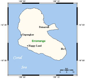
| Map of Erromango | ||
| Waters | Pacific Ocean | |
| Archipelago | New Hebrides | |
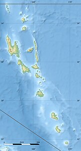
| Geographical location | 18 ° 48 ′ S , 169 ° 4 ′ E | |
|
|
||
| surface | 888.1 km² | |
| Highest elevation |
Santop 886 m |
|
| Residents | 1950 (2009) 2.2 inhabitants / km² |
|
| main place | Potnarvin | |
Erromango is an island in the New Hebrides and is the largest island in Tafea , the southernmost province of Vanuatu . A small side island is the 91 meter high Vete Manung (Île de la Chèvre, Goat Island) (5.6 km northeast, 12 ha area)
The highest point is the Santop with 886 m.
In the 19th century the island was called Martyr's Island.
Sandalwood grows on Erromango . The kauri and tamanu trees are also at home here. Much has been cut down, but nature is gradually recovering. Attempts are currently being made to make the wood industry more environmentally friendly.
There were four languages in the history of Erromango. You , Sorung , Ura and Utaha (Ifo). Today Sorung and Utaha are spoken almost exclusively. There are still a few residents who speak Ura. The languages make up the Erromanga languages , a branch of the South Vanuatu languages .
On November 20, 1839, the British missionary John Williams was killed and eaten by cannibals on Erromango .
Population distribution
Between 1999 and 2009 the population increased from 1560 to 1950.
At the time of the 2009 census, six villages were distinguished, with population figures (from north to south):
![]() Map with all coordinates: OSM | WikiMap
Map with all coordinates: OSM | WikiMap
| Village | Name variants | location | Council Area | Population census 2009 |
Coordinates |
|---|---|---|---|---|---|
| Port Narvin | Potnarvin | Northeast | North Erromango | 550 | 18 ° 44 ′ 51 ″ S , 169 ° 12 ′ 28 ″ E |
| Dillons Bay | Unpongkor | Northwest | North Erromango | 750 | 18 ° 49 ′ 06 ″ S , 169 ° 01 ′ 10 ″ E |
| Ipota | east | South Erromango | 350 | 18 ° 51 ′ 26 ″ S , 169 ° 17 ′ 09 ″ E | |
| Hapiland | Happy Land, Demsal? | southwest | South Erromango | 100 | 18 ° 53 ′ 37 ″ S , 169 ° 03 ′ 17 ″ E |
| South River | Unorah | southwest | South Erromango | 150 | 18 ° 56 ′ 33 ″ S , 169 ° 10 ′ 35 ″ E |
| Antioch | Yawisaghuwi | south | South Erromango | 50 | 18 ° 58 ′ 20 ″ S , 169 ° 14 ′ 20 ″ E |
Individual evidence
- ↑ Vanuatu Census 2009
- ^ V-CAP site: Aniwa, Futuna, Aneityum & Erromango Area Councils, Tafea Province

