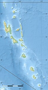
Aniwa (island)
| Aniwa | ||
|---|---|---|
| Map of Tanna , with Aniwa in the northeast | ||
| Waters | Pacific Ocean | |
| Archipelago | New Hebrides | |
| Geographical location | 19 ° 15 ′ 15 ″ S , 169 ° 36 ′ 1 ″ E | |
|
|
||
| length | 7.2 km | |
| width | 1.8 km | |
| surface | 10 km² | |
| Highest elevation | 42 m | |
| Residents | 341 (2009) 34 inhabitants / km² |
|
| main place | Ikaokao | |
Aniwa is an island in the southeast of the island state of Vanuatu in the Pacific Ocean and belongs to the New Hebrides .
The almost 10 km² island is part of the Vanuatu province of Tafea . It is located 30 km northeast of Tanna and 43 km southeast of Erromango , their much larger neighboring island. From 1999 to 2009 the population decreased from 424 to 341.
Aniwa is - in contrast to almost all other islands of Vanuatu - not of volcanic origin, but an upscale atoll ; the highest point is therefore only 42 meters above sea level. The Itcharo Lagoon , open to the northwest, is located in the north of the island. It is about 2.0 km long and one kilometer wide.
Ikaokao , the main town of Aniwa, is in the center, and the largest town is Isavaï on the west coast. There are five villages in total (population figures for the 2009 census for the two largest):
- Ikaokao (Vangawe) (80)
- Imalé
- Isavaï (Imasa) (182)
- Itamotou
- Namsafoura
A current (2015) map source shows a total of more than 20 place names.

