Torres Islands (Vanuatu)
| Torres Islands | ||
|---|---|---|
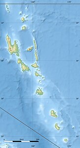
| Topographic map of the Torres Islands | ||
| Waters | Coral sea | |
| Geographical location | 13 ° 15 ′ S , 166 ° 37 ′ E | |
|
|
||
| Number of islands | 7th | |
| Main island | Hi W | |
| Total land area | 117.7 km² | |
| Residents | 826 (2009) | |
The Torres Islands are the northernmost archipelago of the South Pacific island state of Vanuatu . Together with the Banks Islands , they form the Vanuatu province of Torba .
geography
The small group is bordered by the Solomon Islands to the north and the Banks Islands to the southeast. To the west of the Torres Islands , at the tectonic interface of the Australian and Pacific plates, there is a deep sea trench ( Torres Trench ).
The islands extend over about 44 km as the crow flies and, in contrast to almost all other islands of Vanuatu, are not volcanic but coral islands . The highest geographical points are a maximum of 200 m above sea level. The group includes the following islands:
| Island name | Area (km²) |
Population 2009 |
main place | summit | Height (meters) |
Geocoordinate |
|---|---|---|---|---|---|---|
| Hi W | 50.6 | 269 | Gavigamana | Mount Wonvara | 366 | 13 ° 8 ′ S , 166 ° 34 ′ E |
| Metoma | 3.0 | 13 | Rival | ... | 115 | 13 ° 12 ′ S , 166 ° 36 ′ E |
| Tegua | 30.7 | 58 | Lateu | Tawaten | 300 | 13 ° 15 ′ S , 166 ° 37 ′ E |
| Ngwel | 0.07 | - | - | ... | 4th | 13 ° 16 ' S , 166 ° 35' E |
| Linua | 2.2 | - | - | ... | 26th | 13 ° 20 ′ S , 166 ° 38 ′ E |
| Tan | 11.9 | 210 | Lungharegi | ... | 115 | 13 ° 21 ′ S , 166 ° 39 ′ E |
| toga | 18.8 | 276 | Litew | Mount Lemeura | 240 | 13 ° 25 ′ S , 166 ° 42 ′ E |
| Torres Islands | 117.2 | 826 | Lungharegi | Mount Wonvara | 366 | 13 ° 15 ′ S , 166 ° 37 ′ E |
Name of the archipelago
The name Torres Islands is probably derived from the name of the Portuguese navigator Luiz Vaéz de Torres , who visited some of the islands of today's Vanuatu together with the navigator Pedro Fernández de Quirós in the 16th century . The " Torres Strait ", a strait between Australia and New Guinea , and the Torres Strait Islands located there are named after Luiz Vaéz de Torres . The islands off the Australian north coast, however, have nothing to do with the Vanuatu Islands described here and the Torres Islands , which are more than 1700 km to the east .
population
Today 826 people live on the Torres Islands who speak two languages: Hiw and Lo-Toga . The settlement of Lungharegi on the north coast of the island of Loh is the official administrative center of the archipelago, which forms one of the seven municipalities of the Torba province.

