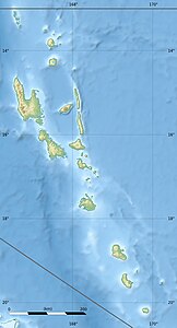
Émaé
| Emae | ||
|---|---|---|
| NASA Geocover 2000 satellite image. The island of Makura can be seen to the south and the Pula Iwa Reef (Cook Reef) to the west . | ||
| Waters | Pacific Ocean | |
| Archipelago | Shepherd Islands | |
| Geographical location | 17 ° 4 ′ S , 168 ° 23 ′ E | |
|
|
||
| length | 11.4 km | |
| width | 4.4 km | |
| surface | 36.5 km² | |
| Highest elevation | Maunga Lasi 644 m |
|
| Residents | 488 (2015) 13 inhabitants / km² |
|
| main place | Makata | |
Émaé is a small island in the group of Shepherd Islands of the South Pacific island state of Vanuatu . It belongs to the central Vanuatu province of Shefa .
geography
Émaé is of volcanic origin; the crater of this largely submarine volcano is very extensive. The two neighboring islands of Makura and Matasu (7 and 17 km south of Émaé, respectively) are part of its edge. The highest point of this small archipelago , Maunga Lasi (Mont Maunga) in the northeast of Émaé, measures 644 m. The central (Mont Talimasa, 434 m) and the southwestern peaks (Mont Painga or Tavania Panga , 528 m) of the island are striking, so that from a distance the island appears as a group of three islands.
4.6 km west of Émaé is the Pula Iwa Reef (Cook Reef) , an atoll without islands, but with dry coral stocks.
The population of Émaé, just under 490 according to the 2015 census, is spread across eight villages. Makata is the main town in the east of the island.
The island's airfield, Siwo Airport with IATA code EAE and ICAO code NVSE, is located in the southwest near the village of Sangafa.
Population and economy
The island is able to support a population of around 750 people. In contrast to the surrounding islands, whose population is Melanesians , the inhabitants of Émaé have Polynesian roots. They speak a dialect of Polynesian called "Emae" belonging to the Futunic branch of the Polynesian languages . Therefore, the island belongs to the outside of the Polynesian triangle lying enclaves Polynesia .
The inhabitants live from a simple form of agriculture and fish. The island has a small airport. Many of the islanders now live in Port Vila , the capital of Vanuatu.
Web links
Individual evidence
- ↑ Sailing Directions (enroute), Pub. 123, page (PDF; 5.1 MB)
- ↑ Denis O'Bryrne, David Harcombe: Vanuatu. Lonely Planet Publications, 1999, 136 (map)
- ↑ 2015 Vanuatu National Population and Households Projections by Province and Islands

