Makura
| Makura | ||
|---|---|---|
| View from the northwest to Makura | ||
| Waters | Pacific Ocean | |
| Archipelago | Shepherd Islands | |
| Geographical location | 17 ° 8 ′ 8 ″ S , 168 ° 26 ′ 17 ″ E | |
|
|
||
| length | 2.1 km | |
| width | 1.1 km | |
| surface | 2.1 km² | |
| Highest elevation | 132 m | |
| Residents | 93 (2015) 44 inhabitants / km² |
|
| main place | Malakof ( Malakoto ) | |
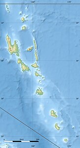
Makura , also called Makoura or Emwae , is a small island in the south of the Shepherd Islands in the South Pacific island state of Vanuatu . It belongs to the central Vanuatu province of Shefa .
Makura lies between the islands of Émaé in the north and Mataso in the south.
According to the 2015 census, the island has 93 inhabitants.

