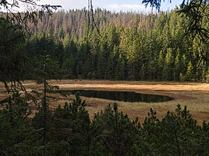
Toporowy Staw Wyżni
| Toporowy Staw Wyżni | ||
|---|---|---|

|
||
| View of the Toporowy Staw Wyżni | ||
| Geographical location | High Tatras , Poland | |
| Location close to the shore | Zakopane , Bukowina Tatrzańska | |
| Data | ||
| Coordinates | 49 ° 16 '46 " N , 20 ° 1' 47" E | |
|
|
||
| Altitude above sea level | 1120 m npm | |
| surface | 0.03 ha | |
| Maximum depth | 1.1 m | |
The Upper Forest Lake ( pl. Toporowy Staw Wyżni ) in Poland is a peat lake in the Seealm valley ( pl. Dolina Suchej Wody ) in the High Tatras . It is located in the municipality of Zakopane . The lake is located in a strictly protected peat landscape above the larger Lower Forest Lake ( Toporowy Staw Niżni ) and is not accessible. It is a refuge for numerous animal and plant species. The lake is expected to silt up in the future, like many other bodies of water in its vicinity that have already dried up. The Oswald-Balzer-Weg panorama road runs not far from the lake .
literature
- Zofia Radwańska-Paryska, Witold Henryk Paryski, Wielka encyklopedia tatrzańska, Poronin, Wyd. Górskie, 2004, ISBN 83-7104-009-1 .
- Tatry Wysokie słowackie i polskie. Mapa turystyczna 1: 25.000, Warszawa, 2005/06, Polkart ISBN 83-87873-26-8 .
Web links
Commons : Toporowy Staw Wyżni - collection of pictures, videos and audio files
