Tryvannstårnet
|
Tryvannstårnet
|
||
|---|---|---|
| Basic data | ||
| Place: | Oslo | |
| Province: | Oslo | |
| Country: | Norway | |
| Altitude : | 536 moh. | |
| Coordinates: 59 ° 59 ′ 19 ″ N , 10 ° 40 ′ 5.1 ″ E | ||
| Use: | TV tower , observation tower , radio tower , VHF transmitter | |
| Accessibility: | TV tower not open to the public | |
| Tower data | ||
| Construction time : | 1962 | |
| Operating time: | since 1962 | |
| Total height : | 118 m | |
| Viewing platform: | 60 m | |
| Closure of the viewing platform: | 2005 | |
| Data on the transmission system | ||
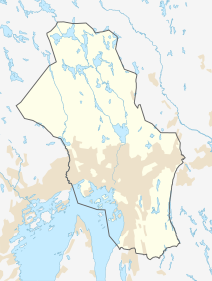
| Position map | ||
|
|
||
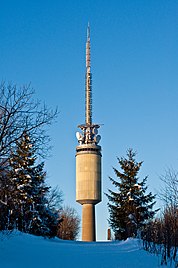
Tryvannstårnet is the name of the 118 meter high television tower in Oslo, built in 1962 . Tryvannstårnet has a viewing platform at a height of 60 meters, from which you can see the Swedish border in good weather . The tower was open to the public until 2004, but was closed to visitors on January 1, 2005 due to new fire protection regulations. A reopening would involve high investment costs.
There are extensive bunker systems in the basement of the tower.
Web links
Commons : Tryvannstårnet - collection of pictures, videos and audio files
- History of Tryvannstårnet (Norwegian)
- Tryvannstårnet. In: Structurae
Individual evidence
- ^ Tryvannstårnet. (PDF; 192 kB) (No longer available online.) Oslo Municipality, Department for Environment and Transport, 23 August 2006, formerly the original ; Retrieved January 16, 2012 . ( Page no longer available , search in web archives ) Info: The link was automatically marked as defective. Please check the link according to the instructions and then remove this notice.


