Tsiigehtchic
| Tsiigehtchic | ||
|---|---|---|
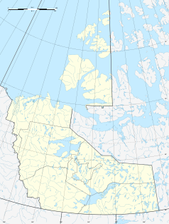
| Location in Canada | ||
|
|
||
| State : |
|
|
| Territory : | Northwest Territories | |
| Region: | Inuvik region | |
| Coordinates : | 67 ° 27 ′ N , 133 ° 44 ′ W | |
| Height : | 6 m | |
| Area : | 48.98 km² | |
| Residents : | 143 (as of 2011) | |
| Population density : | 2.9 inhabitants / km² | |
| Postal code : | X0E 0B0 | |
Tsiigehtchic ("Opening of the Iron River") is a community in the Northwest Territories in Canada with 143 inhabitants (as of 2011) at an altitude of 6 m. ü. M.
It lies at the confluence of the Mackenzie River and the Arctic Red River . Spoken Gwich'in and English. The inhabitants live mainly from fishing and hunting. The community has a volunteer fire brigade , no police, two churches and a grocery store.
history
The construction of the Dempster Highway drew more and more people into the community. Before it was built, only three families lived in the community. Until 1994 the parish was called Arctic Red River .
tourism
Tsiigehtchic is 66 kilometers from Nutuiluie Park . Other attractions include the Richardson Mountains and the Peel River Game Reserve .
Web links
- Gwich'in Tribal Council (English)
- Gwich'in Community of Tsiigehtchic (English)
- Legislative Assembly of the NWT (English)
- Statistics (English)

