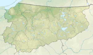
Tumiańskie
|
Tumiańskie Thumb Lake |
||
|---|---|---|
| Geographical location | Powiat Olsztyński , Warmian-Masurian Voivodeship , Poland | |
| Tributaries | Serwent → Wardęga | |
| Drain | Dadaj → Pisa Warmińska → Wadąg → All | |
| Places on the shore | Tumiany | |
| Location close to the shore | Bartołty Wielkie , Barczewo , Klimkowo | |
| Data | ||
| Coordinates | 53 ° 48 ′ 10 " N , 20 ° 48 ′ 28" E | |
|
|
||
| Altitude above sea level | 115 m npm | |
| surface | 1.206 km² | |
| length | 2.3 km | |
| width | 800 m | |
| Maximum depth | 17 m | |
| Middle deep | 6.7 m | |
Tumiańskie ( German Thumb Lake ) is an inland lake of 121 hectares in the Warmian-Masurian Voivodeship . The Wardęga River flows into the southern bank of the lake .
Geographical location
Tumiańskie Lake is located in the Barczewo City and Rural Municipality .
