Tuti Island
| Tuti Island | ||
|---|---|---|
| Waters | Nile | |
| Geographical location | 15 ° 37 ′ N , 32 ° 30 ′ E | |
|
|
||
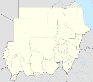
The Tuti Island ( Arabic توتي, DMG Tūtī ) is a crescent-shaped inland island of the Nile at the confluence of the White and Blue Nile in Sudan .
The almost eight square kilometer island is located in the middle of the tri-city region of Omdurman in the west, Khartoum in the south and al-Chartum Bahri (Khartoum north) in the northeast. It has been inhabited since the end of the 15th century and thus far longer than the cities of Khartoum and Omdurman, which were only founded in the 18th century. The inhabitants of the island, who are locally called Tawwata , belong mainly to the Nubian ethnic group of the Mahas, whose native language is a dialect of Nobiin . While the population of the cities increased tenfold between 1956 and 1990, the number of inhabitants on the island only rose from 5851 to 9416. Only since the 1990s has the population increased to a small extent, also through immigration.
The only village has a closely built-up core area and a few more distant collections of houses. The oldest buildings in the area are concentrated around the mosque. The buildings are single-storey and are, as is customary for the northern Sudanese traditional way of settlement, with an inner courtyard within a two-meter-high wall. The bricks used for construction are burned on the island. The population lives from cultivation in the irrigated fields, the fertile soil of which has arisen from deposits of Nile mud . The agriculturally used areas, of which there are only a few in the vicinity of Khartoum, limit the further expansion of the village. Vegetables, citrus fruits and bananas flourish. The island's edge areas are irrigated in August / September by annual flooding of the Nile, otherwise by diesel pumps.
Until March 2009, Tuti Island could only be reached by ferry from Khartoum. Since then, the Tuti Bridge has led to the eastern tip of the island. The Tuti Island is the unusual case of an early settled and strategically located island that did not become the center of the later city foundation on the mainland.
Web links
- Omeima Khidir: Bridging between the Contemporary and the Vernacular Architecture. Diss. University of Khartoum, 1998. Chapter 9: About Tuti the Island and the Village. Pp. 11–14 PDF file; 8 MB
Individual evidence
- ↑ HRJ Davies: A rural "eye" in the Capital: Tuti Iceland, Khartoum, Sudan. GeoJournal, Springer, Vol. 33, No. 4, August 1994, pp. 387-392


