Ulawa
| Ulawa | ||
|---|---|---|
| Beach at Lengua Village, West Coast (1906) | ||
| Waters | Pacific Ocean | |
| Archipelago | Solomon Islands | |
| Geographical location | 9 ° 46 ′ S , 161 ° 57 ′ E | |
|
|
||
| length | 17 km | |
| width | 5 km | |
| surface | 66 km² | |
| Highest elevation | 343 m | |
| Residents | 3297 (2009) 50 inhabitants / km² |
|
| main place | Hadja | |
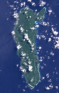
| NASA satellite image of Ulawa ( Landsat 7 ) | ||
Ulawa is an island of the island state of the Solomon Islands and part of the Makira and Ulawa Province . Ulawa is located about 40 km southeast of the next larger island Maramasike (South Malaita). The main island of the province, Makira ( formerly San Cristobal ), is about 65 km away.
geography
Ulawa has an area of about 66 km² and about 3,300 inhabitants. It has a hilly, densely forested landscape. The highest point rises 343 meters. The main town is Hadja on the west coast.
The island has been inhabited since around 750 AD. The Spanish explorer Alvaro de Mendaña sighted Ulawa in 1568.
The island's population speaks a dialect of the Austronesian language Sa'a .
Individual evidence
- ↑ David Harcombe: Solomon Islands. A travel survival kit . Lonely Planet Publications, Hawthorn, Vic. 1993, ISBN 0-86442-168-0 , p. 208.
Web links
- Solomonislands.com ( Memento of December 3, 2008 in the Internet Archive )


