Umm Badr Lake
| Umm Badr Lake | ||
|---|---|---|

|
||
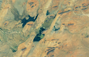
| Satellite image of the divided Umm-Badr-See | ||
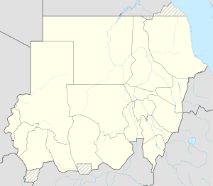
| Geographical location | Central Sudan | |
| Tributaries | no | |
| Drain | Wadi al-Milk → Nile | |
| Location close to the shore | al-Ubayyid | |
| Data | ||
| Coordinates | 14 ° 15 ′ 0 ″ N , 27 ° 50 ′ 0 ″ E | |
|
|
||
| Altitude above sea level | 600 m | |
| surface | 20 km² | |
|
particularities |
Divided into two parts during the dry season |
|
The Umm Badr Lake ( Arabic بحيرة أم بادر, DMG Buḥairat Umm Bādir ; English: Umm Badr Lake ), is located on the southern foothills of the Sahara , between the Sudanese cities of al-Ubayyid and al-Faschir in the state of Shamal Kurdufan .
The lake is located in a basin that is characterized by stony mountains and high dunes of red sand.
In the rainy season, the lake is up to six kilometers long and two kilometers wide and floods the northern end of its lake basin and forms the Wadi el-Melek with its water .
During the dry season, the lake shrinks and splits into two parts.
