Urda Ridge
| Urda Ridge | ||
|---|---|---|
|
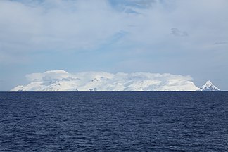
Clarence Island with Mount Irving (left) in Urda Ridge |
||
| Highest peak | Mount Irving ( 1950 m ) | |
| location | Clarence Island , South Shetland Islands | |
|
|
||
| Coordinates | 61 ° 16 ′ S , 54 ° 8 ′ W | |
Urda Ridge (English; Bulgarian Урдин хребет Urdin chrebet ) is a mountain ridge in the center of the southern part of Clarence Island in the archipelago of the South Shetland Islands . In the north-northeast-south-south-west extension it is 8 km long, in the west-northwest-east-southeast extension 9 km wide and in Mount Irving up to 1950 m high. It is connected to the Ravelin Ridge to the north via the Soyka Saddle .
British scientists mapped it in 1972 and 2009. The Bulgarian Commission for Antarctic Geographical Names named it in 2014 after the Thracian town of Urda in the south of today's Bulgaria .
Web links
- Urda Ridge in the Composite Gazetteer of Antarctica (English)

