
Utupua
| Utupua | ||
|---|---|---|
 |
||
| Waters | Pacific Ocean | |
| Archipelago | Santa Cruz Islands | |
| Geographical location | 11 ° 16 ′ S , 166 ° 31 ′ E | |
|
||
| length | 14 km | |
| width | 10 km | |
| surface | 69 km² | |
| Highest elevation | Mount Royal (Mt Rautahnimba) 378 m |
|
| Residents | 1168 (2009) 17 inhabitants / km² |
|
| main place | Nembao | |
 |
||

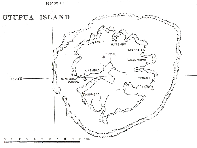
Utupua , also Tapoua or Lord Edgecombe Island , is an island in the Santa Cruz Islands of the island state of the Solomon Islands . The 378 meter high island lies between Vanikoro and Santa Cruz . The island is completely surrounded by a coral reef .
In 2009, there were 1,168 people on Utupua who were spread across various small villages. The most important villages are Nembao (main town, located on the north side of the entrance to Basilisk Harbor in the west of the island), Avita , Malombo , Tanimbili (Tanabili) , Apakho (Apakhö) and Asimboa . Administratively, the island belongs to the Temotu province .
Utupua is one of only three islands that still has the Santa Cruz pigeon , a species of pigeon that is classified as critically endangered by the IUCN .
supporting documents
- ↑ BirdLife Factsheet about the Santa Cruz Pigeon (Accessed July 4, 2009)
Web links
- Utupua Island, Solomon Islands (Internet Archive) ( Memento from February 7, 2012 in the Internet Archive )
- Sketch map of Utupua