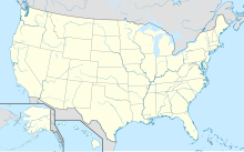
Vermilion Oilrig 380
Coordinates: 28 ° 12 ′ 0 ″ N , 92 ° 12 ′ 0 ″ W.
Vermilion Oilrig 380 , also Vermilion Oil Platform 380 , is an oil production platform in the Gulf of Mexico .
The platform is located 130 kilometers south of Vermilion Bay in Louisiana . The water depth at the point is 750 meters. The owner is the Houston- based Mariner Energy company . In 2009 it is said to have produced around 31 billion liters of oil from the Vermilion 380 oil field.
On September 2, 2010, there was an explosion. The 13 employees on the platform were saved. At that time it was said that the platform had not produced anything, later it was said that around 225,000 liters of oil and 25,000 cubic meters of natural gas would be produced every day.
According to the US Coast Guard, an approximately 1.5 km long oil veil was discovered after the explosion, floating on the water near the platform. The environmental protection organization Greenpeace reacted alarmed to the renewed accident.
See also
Web links
- New Orleans Blog Topic: Coast Guard responding to rig fire Gulf of Mexico; people reported in water ... (with position map)
Individual evidence
- ↑ ABC ( Memento of the original from December 3, 2010 in the Internet Archive ) Info: The archive link was inserted automatically and has not yet been checked. Please check the original and archive link according to the instructions and then remove this notice.
- ↑ 20min.ch
- ↑ MIRROR
