Veun Kham
| Veun Kham | ||
|---|---|---|
|
|
||
| Coordinates | 13 ° 56 ' N , 105 ° 59' E | |
| Basic data | ||
| Country | Laos | |
| Champasak | ||
| ISO 3166-2 | LA-CH | |
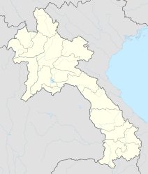
Veun Kham (also: Veung Kham , Voen Kham or Voeun Kham ) is a Laotian village in the extreme south of the Champasak province , Khong district , right on the border with Cambodia .
The place is located immediately south of the Mekong Falls on the eastern bank of the river and is considered the southern end of the Si Phan Don area . The distance to Don Khong is a good 30 km; the next largest Cambodian city of Stung Treng is 57 km away.
Veun Kham is best known as a border crossing from Laos to Cambodia. The border town on the Cambodian side is Dong Krolor (also Dom Kralor or Dong Kalaw), about 10 km further east .
A massive border stone with French lettering is located near the two places , which marks the state border. The Asian Highway 11 passes here and the Laotian National Road 13 merges into the Cambodian National Road 7 .
In the past there were two border control posts : One in Veun Kham, which was primarily responsible for ship travelers, and one in Dong Krolor, which handled road traffic. As a result of the expansion and new construction of the Cambodian road connection to Stung Treng in the early 2000s, the two states agreed to restructure the border crossing and to merge the two control posts into a single, larger and more modern crossing near Dong Krolor, which also means one Promised to promote trade and tourism. The border post directly on the Mekong in Veun Kham has been officially closed since then.
The new border crossing was opened in April 2009, on the eve of the Khmer New Year celebrations . The place on the Laotian side was renamed Nong Nokkhien , the Cambodian side is now called Trapaing Kreal . On the occasion of the reopening, entry into the two countries was also simplified; visas are now also issued at the border (“Visa on Arrival”).
