Ciudad Nicolás Romero
| Ciudad Nicolás Romero | ||
|---|---|---|
|
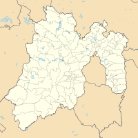
Coordinates: 19 ° 35 ′ N , 99 ° 22 ′ W Ciudad Nicolás Romero on the map of Mexico
|
||
| Basic data | ||
| Country | Mexico | |
| State | México | |
| Municipio | Nicolás Romero | |
| Residents | 340,300 (2019) | |
| Detailed data | ||
| surface | 36.8 km² | |
| height | 2390 m | |
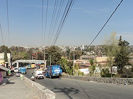
| view on the city | ||
Ciudad Nicolás Romero is a city in Mexico . It is the headquarters of the Municipio Nicolás Romero in the state of México . It is located 58 km from the city of Toluca de Lerdo , the capital of the state, and is located in the north-central part of the state, just northwest of the federal district of Mexico City . The city is part of the Zona Metropolitana del Valle de México .
history
The area was settled by the Otomi and named by the Aztecs after the conquest by them Azcapotzaltongo ("between the anthills" in Náhuatl ). During the colonial period it was known as San Pedro Azcapotzaltongo. From 1821 to 1898, when the current name was adopted, it was then called Monte Bajo. The city bears the current name in honor of Nicolás Romero , who fought for Benito Juárez during the Reform War and the French intervention in Mexico . He was executed there by the French. In 1898 the seat was renamed "Villa Nicolás Romero" after it was given city status. In 1998 the place was elevated to the status of a city and its current official name is Ciudad Nicolás Romero. Both the parish and town are commonly known as Nicolás Romero.
economy
Industrialization began here in the mid-19th century with factories such as the textile mills "Molino Viejo" (today La Colmena), "Rio Grande" and "San Ildefonso" and the yarn manufacturer Barrón, all of which are still in operation. This continued into the 20th century with paper products and other types of production.
Web links
Individual evidence
- ^ Estado de México - Nicolas Romero. September 30, 2007, accessed February 6, 2020 .

