Vilnia
| Vilnia | ||
|
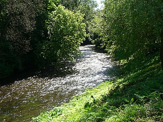
The Vilnia in Vilnius |
||
| Data | ||
| location | Lithuania , Belarus | |
| River system | Memel | |
| Drain over | Neris → Memel → Baltic Sea | |
| source | 5 km south of Šumskas near the Josephsberg 54 ° 36 ′ 0 ″ N , 25 ° 44 ′ 7 ″ E |
|
| muzzle | In Vilnius in the Neris coordinates: 54 ° 41 ′ 20 ″ N , 25 ° 17 ′ 33 ″ E 54 ° 41 ′ 20 ″ N , 25 ° 17 ′ 33 ″ E
|
|
| length | 79 km | |
| Catchment area | 624 km² | |
| Drain |
MQ |
5.63 m³ / s |
| Big cities | Vilnius | |
| Medium-sized cities | Naujoji Vilnia | |
The Vilnia (also Vilnelė , Belarusian Вільня Wilnja ; Polish Wilenka ) rises not far from the highest point in Lithuania , not far from the border with Belarus , along which it flows a few kilometers.
Sometimes it has a considerable gradient : 40 m difference in altitude over 10 km, which makes paddling like white water possible in places . In Vilnius it separates the Užupis district from the old town, flows along the Kalnų parka and flows into the Neris below the Gediminas Castle .
The course of the Vilnia used to be divided in two at the mouth, so it also formed the moat for the Vilnius Castle .
literature
- Aleksandras Vanagas. Lietuvių hidronimų etimologinis žodynas. - Vilnius: Mokslas, 1981.
Web links
Commons : Vilnia - collection of pictures, videos and audio files
