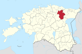
Vinni
| Vinni | |||
|
|||
| State : |
|
||
| Circle : |
|
||
| Coordinates : | 59 ° 18 ' N , 26 ° 26' E | ||
| Area : | 486.65 km² | ||
| Residents : | 6,812 (January 1, 2018) | ||
| Population density : | 14 inhabitants per km² | ||
| Time zone : | EET (UTC + 2) | ||
| Website : | |||

|
|||
Vinni (German Finn ) is a rural community in the Estonian district of Lääne-Viru with an area of 486.65 km². It has 6812 inhabitants (as of 2018).
structure
In addition to the main town Pajusti (758 inhabitants) includes the community villages Alavere, Allika, Anguse, Aravuse, Aruküla, Aruvälja, Inju, Kadila, Kakumäe, Kannastiku, Karkuse, Kaukvere, Ḳehala, Koeravere, Kulina, Kuti, Lepiku, Lähtse, Mõdriku , Mäetaguse, Nurmetu, Obja, Palasi, Piira, Puka, Rasivere, Ristiküla, Roela ( Ruil ), Rünga, Saara, Soonuka, Suigu, Tammiku, Tudu, Vana-Vinni, Veadla, Vetiku, Vinni, Viru-Jaagupi , Voore and Võhu.
Attractions
The Roela manor house ( Ruil in German ) is particularly worth seeing . It was first mentioned in 1486. In 1840 it was bought by the Baltic German explorer and Governor General of Alaska , Ferdinand von Wrangel .
This architecturally interesting manor of Mõdriku (German Mödders ) belonged to the aristocratic German Baltic families of Kaulbars and Dehn

