Virisen
| Virisen | ||
|---|---|---|

|
||
| View of the Virisen from Bojtiken | ||
| Geographical location | Lapland , Sweden | |
| Drain | Vapstälven | |
| Location close to the shore | Storuman (place) | |
| Data | ||
| Coordinates | 65 ° 25 ′ N , 15 ° 10 ′ E | |
|
|
||
| Altitude above sea level | 605 m above sea level | |
| surface | 28 km² | |
| length | 15 km | |
| width | 2 km | |
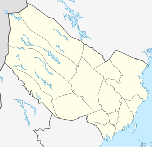
Virisen (South Sami: Vijriesjaevrie ) is a lake on the border of the municipality of Storuman to the municipality of Vilhelmina in Västerbotten County in the Swedish historical province of Lapland . It is located at an altitude of 605 m above sea level. and is 28 km² in size. The lake drains via the Vapstälven , which continues as Skardmodalselva from the Norwegian border , to the European Arctic Ocean .
The approximately 15 long and up to 2 km wide, fish-rich lake stretches from Bojtiken in the west, where it is touched by a touristically significant side road ( Sagavägen ), which leads from Hattfjelldal in Norway to the east towards Europaväg 12 , to the east.
Individual evidence
- ↑ [1]
- ↑ Sverige vägatlas, Norstedts, Stockholm, 2014, ISBN 978-91-1305683-8
- ↑ Sverige vägatlas, Norstedts, Stockholm, 2014, ISBN 978-91-1305683-8
