Desert near Afferde
The desert near Afferde was a medieval settlement near Hamelin 's Afferde district that fell in desolation .
The settlement was about 1.3 km east of today's center of Afferde. It was located on a slight slope above the Remte brook and has been known from excavations since 1993. Aerial photos suggest further building remains in the ground. According to a map of the Electoral Hanover land survey from 1782, the former settlement was where two long-distance routes crossed. Here was a route running in east-west direction from the Belgian North Sea coast near Bruges to the Russian city of Novgorod , in Germany today Bundesstraße 1 . An old long-distance path ran in a north-south direction and passed the settlement. This could be Badersen or Bahrßen , as mentioned in historical records from the 15th century .
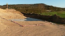
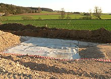
In 2017, the remains of a mine house were discovered during the construction of a wind turbine in the desert area . At the instigation of the responsible local archaeologist Jens Berthold von der Schaumburger Landschaft, this led to an archaeological excavation during which a 3 × 4 meter large and 1.3 meter sunk structure with six posts was uncovered. It could be dated to the time between the 9th and 11th centuries on the basis of pottery, including spherical pot ware , and is attributed to the desert.
Web links
- Wolfhard F. Truchseß: Afferde much older than previously assumed in Dewezet on November 6, 2019
Individual evidence
- ^ Document book of the council and the city of Hameln , Hanover and Leipzig, Hahnsche Buchhandlung , 1903
- ↑ Joachim Schween: Afferde FStNr. 20, Gde. Stadt Hameln, Ldkr. Hameln-Pyrmont in: News from Lower Saxony's Prehistory , Fundchronik 2017, pp. 93–96
Coordinates: 52 ° 6 ′ 17.8 " N , 9 ° 25 ′ 45.3" E

