Kurhannoversche Landesaufnahme

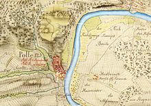
The Kurhannoversche Landesaufnahme was the first extensive land registry in the Electorate of Braunschweig-Lüneburg ("Kurhannover"). It is also known as the Kurhannoversche Landesaufnahme of the 18th century .
description
The map series was recorded by officers Georg Josua Du Plat and Johann Ludewig Hogrewe of the Hanoverian engineering corps between 1764 and 1784 on a scale of 1: 21.333⅓ and had 165 sheets. Larger cities and fortresses are recorded on a scale of 1: 2000 and maps of the vicinity of towns on a scale of 1: 10,600. Only a complete copy of the map series, from which a “military map” (scale 1: 64,000) and from it a “general map” (scale 1: 192,000) was developed by being reduced in size three times, can be found in the Berlin city library . The State Office for Geoinformation and Land Surveying Lower Saxony (LGLN) offers single and multi-colored, slightly reduced reproductions (scale 1: 25,000) of today's 165 sheets of maps.
The cards are drawn with great care according to a uniform scheme with blue and brown ink, Chinese ink, carmine, rubber gutti, Berlin blue and verdigris. The representations are also partly plastic, as special or public buildings have a short shadow. Fields have furrow markings that show the direction of the plow. In the case of forests, a distinction is made between deciduous and coniferous forest as well as between light and dense forest. There is a light green color in the meadow land, a distinction to gray-black wasteland. Hillshade and hatching were used for elevations , with steep slopes being drawn darker. The cards have numerous notes that indicate, for example, affiliations, possessions and local conditions. The names of nobles are written in red. In the case of buildings, the number of fireplaces is listed. Borders were drawn in with particular precision and in different colors, such as national borders (red), office borders (green) and court borders (yellow). Municipal boundaries are not included, however.
meaning
The special value of the detailed map series of the Kurhannoverschen Landesaufnahme is that it gives an unadulterated picture of the landscape of that time before the upheavals caused by the French Revolution . For today's local research , the given field names and boundaries are of great value.
See also
- Triangle points of the surveying Hoher Hagen (Dransfeld) , Brocken , Großer Inselsberg
- List of map series
- Gaussian land survey
- Prussian land survey
literature
- Werner Kost: The Kurhannoversche Landesaufnahme 1764–1786 . In: Erich Schrader (ed.): The landscapes of Lower Saxony. Construction, image and interpretation of the landscape. A topographical atlas . Published by the Lower Saxony State Surveying Office. K. Wachholtz, Neumünster, 4th edition 1970.
Maps
- August Papen : Topographical Atlas of the Kingdom of Hanover and the Duchy of Braunschweig based on the complete triangulation directed by the Privy Councilor Gauss. Hanover 1832–1847.
- Franz Engel: The Kurhannoversche land survey of the 18th century. Explanations for the new edition of the official historical map series on a scale of 1: 25,000 (with sheet overview and explanation of symbols) . 2nd Edition. Hanover, 1978.
Web links
- Kurhannoversche Landesaufnahme (LGN)
- Kurhannoversche Landesaufnahme (LGN), download of all maps in reduced resolution
Individual evidence
- ^ State Office for Geoinformation and Land Development Lower Saxony (LGLN): Kurhannoversche Landesaufnahme des 18. Century. (see web links)
- ↑ a b Klaus Mlynek : Du Plat, Georg Josua. In: Klaus Mlynek, Waldemar R. Röhrbein (eds.) U. a .: City Lexicon Hanover . From the beginning to the present. Schlütersche, Hannover 2009, ISBN 978-3-89993-662-9 , p. 141.
