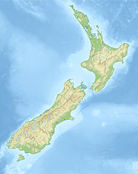
Wairarapa earthquake of 1942
| Wairarapa earthquake of 1942 | ||
|---|---|---|
|
|
||
| Coordinates | 40 ° 57 '36 " S , 175 ° 40' 12" E | |
| date | June 24, 1942 | |
| Time | 11:16 a.m. local time | |
| intensity | 8 on the MM scale | |
| Magnitude | 7.2 M S | |
| depth | 12 km | |
| epicenter |
Wairarapa
(near Masterton )
|
|
| country | New Zealand | |
| Affected places | ||
| Tsunami | No | |
| dead | 1 | |
| Injured | 2 | |
The two Wairarapa earthquakes on the North Island of New Zealand in 1942 were 7.2 and 7.0 magnitudes and were only five and a half weeks apart.
geography
The epicentres of the earthquakes were both on the line near the Wairarapa Fault and only about 5–10 km apart. The area is characterized by some branches of the main fold ( Carterton , Masterton and Mokonui Fault ). The Wairarapa Fault itself extends starting at the level of the Tararua Range in a south-westerly direction along the Remutaka Range to then expire in the seabed of the Cook Strait .
The quakes
First quake
On June 24, 1942 at around 8:14 p.m., a small quake occurred near Masterton . The main earthquake, which then followed at around 11:16 p.m. at night with a magnitude of 7.2 M S for one minute, could be felt from Auckland down to Dunedin on the South Island . The wide spread of the quake can be explained by the shallow depth of the epicenter of only 12 km. Throughout the night, over 200 aftershocks did not allow the population to calm down.
In Masterton, near the center of the quake, the business area was hit particularly hard. Most of the commercial buildings that had bricked their facades with bricks couldn't withstand the shock waves . The wooden single-storey houses withstood the vibrations better, but hardly any of the brick chimneys survived the quake.
In Masterton, the army called for help decided to demolish St. Matthew's Church because of serious damage. A sixteen-pound explosive device should collapse the building. After the church withstood the demolition and a second, stronger demolition finally brought down the building, more severe damage was recorded to the surrounding residential buildings than had caused the previous earthquake.
In Wellington, 80 km away, brick walls, cladding or decorations gave way. The numerous landslides, however, caused greater danger and impairment.
Second quake
Just five and a half weeks later, just as the damage from the first quake was being repaired, the earth shook again with a magnitude of 5.6, followed by a major tremor of magnitude 7.0 M S the following day at around 12:34 p.m. However, since this quake had its center at a depth of 40 km, the spread and the damage caused were not as great as the quake on June 24th.
See also
Web links
- M 7.2, Wairarapa I, June 24, 1942 . GeoNet - GNS Science ,accessed April 7, 2013.
- M 7.0, Wairarapa II, August 2, 1942 . GeoNet - GNS Science ,accessed April 7, 2013.
- A Night of Terror - The 1942 Earthquake . Masterton District Library & Wairarapa Archive,accessed March 5, 2010.
- Story: Historic earthquakes - The 1942 Wairarapa earthquakes . Te Ara - The Encyclopedia of New Zealand,accessed March 5, 2010.
Individual evidence
- ^ M 7.2, Wairarapa I, June 24, 1942 . GeoNet - GNS Science , accessed April 7, 2013 .
- ↑ a b M 7.0, Wairarapa II, August 2, 1942 . GeoNet - GNS Science , accessed April 7, 2013 .
