Wanker stain
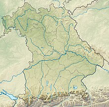
The wanker stain in Bavaria |
Wankerfleck is the field name for a valley floor in the Ammergau Alps .
Surname
The spelling Wankfleck can be found in the topographical map of the Bavarian land survey from the 19th century .
location
The Wankerfleck is about 1140 m above sea level. NHN Höhe, in the Bavarian part of the Ammergau Alps and in the area of the Ostallgäu district . To the south of the Wankerfleck, the high plateau massif towers over the surrounding area. Due to its central location in the Ammergau Alps nature reserve , the Wankerfleck can only be reached via forest roads that are closed to general vehicle traffic. The Kenzenbach flows in the northern part of the Wankerfleck .
Attractions
The extensive alpine meadows of the Wankerfleck are framed by dense forests. In the background rise the peaks in the area of the Hochplatte and form a high alpine backdrop. The Geiselstein shows itself here with its quite striking northeast view. This is what the hiker can do
"... one of the most picturesque places in the foothills of the Alps."
On the eastern edge of the Wankerfleck, not far from the paved forest road, there is the memorial chapel in honor of the failed mountain climbers. The Bockstallsee lies a little below the alpine meadows .
literature
- Area map UK L 10 of the Bavarian State Office for Surveying 2007
Individual evidence
- ^ Original position sheet No. 861 of the Bay. Land survey from 1831. [1]
- ↑ Federal Office for Cartography and Geodesy , State Office for Surveying and Geoinformation Bavaria : Digital Topographical Map 1:25 000, [2] , accessed on January 9, 2016
- ↑ KOMPASS hiking, biking, ski touring and cross-country skiing map: Füssen Ausserfern No. 4, 1: 50,000, KOMPASS-Karten GmbH, Rum / Innsbruck
- ^ Dieter Seibert: Tannheimer Tal and Jungholz. Selection guide for the areas around Tannheim, Nesselwängle and Jungholz , Bergverlag Rother GmbH, 1996 - 123 pages, quotation taken from page 101
- ^ Franziska Baumann: Hiking by the water in the Bavarian Alps: mountain lakes, gorges and torrents , Bergverlag Rother GmbH, 2011, page 17
Coordinates: 47 ° 34 ′ 10 ″ N , 10 ° 50 ′ 30 ″ E


