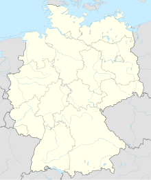
Wanlefsrode
Coordinates: 51 ° 53 ′ 35 ″ N , 10 ° 37 ′ 6.6 ″ E
Wanlefsrode (also: Wanleffesrode ) is in the field of today's National Parks resin in Bath resin Burg lying Klosterwüstung .
history
etymology
The ending -rode indicates a clearing settlement typical of this region , while the first tribe refers to the name of the local founder, a monk Wanlef .
Early history
Said monk is said to have lived there at the beginning of the 11th century AD and founded this settlement; the first mention of the place took place around a century later in a document in 1110. The place was created as an outside provostry of the Ilsenburg monastery . Heinrich II founded a church in Wanlefsrode, which was dedicated to St. Stephen . Around 1340 the village fell into desolation.
Modern times
Today there are only marginal remains of the former ramparts, but these can be seen with a trained eye. In 2008, students from the Institute for Cartography and Geoinformatics at Leibniz University in Hanover began exploring the site.
geography
The remains of Wanlefsrode are in a secluded clearing, which is known today as cell wood and is located a few hundred meters south of the L 501 state road in the Schimmerwald. A hiking trail and several small streams lead through the area.
Web links
Individual evidence
- ↑ Bernd Stenal, Lisa Berg: The Harz - History 2: Early and High Middle Ages. 2012. p. 114.
- ↑ Search for a missing monastery in the Harz Mountains - Berliner Morgenpost on morgenpost.de , accessed on October 25, 2017.
- ↑ Bernd Stenal: The Harz - History 5: The time of the Thirty Years War. 2015. p. 72.
