
Washington State Route 409

|
|
|---|---|
| map | |

|
|
| Basic data | |
| Overall length: | 6.18 km or 3.84 miles |
| Opening: | 1964 |
| Starting point: | Ferry dock on Puget Island |
| End point: |
|
| County: | Wahkiakum County |
The Washington State Route 409 (SR 409) is a short state highway in Wahkiakum County in Washington . It connects the river island of Puget Island with the north bank of the Columbia River .
Route description
The SR 409 begins at the ferry terminal on Puget Island. The ferry connects the island in the Columbia River with Westport in Oregon on the south side of the river. The road runs straight north across the island from there until it reaches the northern shore. There it makes a small bend to the west and then crosses the arm of the river on the Julia Butler Hansen Bridge. On the bank, the road reaches the small town of Cathlamet . As Front Road and Main Street , it continues north there and finally ends at an intersection at Washington State Road 4 .

Ferry dock on Puget Island
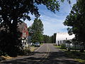
Road on Puget Island

Julia Butler Hanson Bridge as seen from Cathlamet
.jpg)

.jpg)
history
The road on Puget Island was built in 1925, and the ferry service between the island and both banks began in the same year. In 1939 a bridge was built between the island and the north side of the river, replacing the ferry on that side. The bridge was then called Puget Island-Cathlamet Bridge , later it was renamed in honor of the politician Julia Butler Hansen . In 1943 the road was elevated to Secondary State Highway 12F , in 1964 it was given its current name.
Web links
Individual evidence
- ↑ Kit Oldham: Walter Coates begins ferry service across the Columbia River via Puget Island in June 1925. December 13, 2006, accessed on July 22, 2020 (English).
- ↑ Priscilla Long: Wahkiakum County's Julia Butler Hansen Bridge is completed in August 1939. December 12, 2006, accessed on July 22, 2020 .