Weesries
|
Weesries
Wees parish
Coordinates: 54 ° 47 ′ 42 ″ N , 9 ° 31 ′ 21 ″ E
|
||
|---|---|---|
| Postal code : | 24999 | |
| Area code : | 04631 | |
|
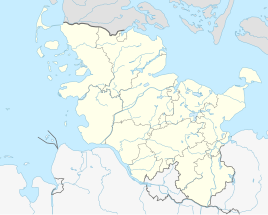
Location of Weesries in Schleswig-Holstein |
||
|
Sign to Weesries on Weesrieser Straße near Rosgaard .
|
||
Weesries ( Danish : Vesris ) is a place in the municipality of Wees in the Schleswig-Flensburg district .
location
The village houses Weesries are largely on the same street Weesries , east of Weesrieser woods remote Something north of the actual street village where Weesrieser road lie the farm Andresen , the large number of buildings there and the wood processing plant timber connection which also made several Buildings. Furthermore, the address Rüllschauer Weg 1, west of the street Weesries belongs to the place ( location ). The main town Wees is about a kilometer north of the town.
background
The name “Weesries” is made up of the place name “Wees” and the word “Ries”, which means “forest”. Weesries was apparently originally just the name for the neighboring Weesries wood, which is still now and then also called "Weesries" for short, although nowadays mainly the place is called that.
On a very detailed Danish map from 1857/58 the street village of Weesries with several buildings to the west of the forest was already recognizable, but not yet named. In 1863 the place Weesries was also mentioned by name on another map. The place was re-entered on the map of the Prussian Land Registry around 1879.
In 1961 the village of Weesries had 35 inhabitants and in 1970 it had 31 inhabitants.
Individual evidence
- ↑ Wees parish. About us , accessed on: July 5, 2020
- ↑ Andresen Adventure Farm , accessed on: July 7, 2020
- ↑ The wood connection. Info , accessed on: July 7, 2020
- ↑ The property belonged to Weesries before. On the said property there is a house with a kind of extension and a garage. The Rüllschauer Weg (which leads to the village of Rüllschau ) was laid out in the 1960s as part of the North program .
- ↑ See Flensburg street names . Society for Flensburg City History, Flensburg 2005, ISBN 3-925856-50-1 , article: Kluesrieser Weg
- ↑ Danish Royal Library : Slesvigs Fastland og Als, Generalstaben Videnskabernes Selskab 1857/58 (or Google translation: there )
- ↑ Map of the greater Flensburg area from 1863 (apparently revised there after the German-Danish war )
- ^ Prussian land survey around 1879 ; a map of the Prussian land survey
- ^ Genealogy. (Dorf) Weesries , accessed: July 1, 2020

