Wellesley Island State Park
|
Wellesley Island State Park
|
||
|
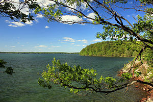
Shore in Wellesley Island State park |
||
| location | Wellesley Island , Jefferson County , New York (State) , United States | |
| surface | 10.67 | |
| Geographical location | 44 ° 19 ' N , 76 ° 1' W | |
|
|
||
| Setup date | 1951 | |
| administration | New York State Office of Parks, Recreation and Historic Preservation | |
Wellesley Island State Park is a state park on Wellesley Island in the Saint Lawrence River in the parish of Orleans in Jefferson County , New York . The park covers an area of 2,636 acres (10.67 km²) and is divided into different areas that are scattered around the island. It also has the largest camping complex in the Thousand Islands , including wilderness campsites on the banks of the St. Lawrence , which can only be reached on foot or by boat. The park is open all year round.
geography
The park extends over the northwestern shores and parts of Wellesley Island , which is divided into a northern and a southern half by a bay of St. Lawrence and the range of hills. The Interstate 81 cuts through the park partially on its eastern side, shortly before her own endpoint at the Canadian border . The park itself borders largely on Canadian territory in the north ( Stave Island , Rich Island , Rowley Island , Downie Island , Spilsbury Island , O'Conor Island , Sir William Island , Myers Island , Bingham Island , Butts Island , Hill Island ). In the south it borders on the Thousand Island Park settlement with the Thousand Island Marina . In the extension of Wellesley Island, the islands of Murray Isle , Hub Island and Grenell extend to the southwest. The highest peaks in the park rise to about 106 m above sea level . The banks of the St. Lawrence are at a height of about 76 m. Eel Bay forms a large stretch of shore and the elevations run parallel to the direction of the island from southwest to northeast and form a small valley in the middle of the park, in whose lowlands there are wetlands at the level of the St. Lawrence River.
On Wellesley Island there are still the older state parks Dewolf Point State Park (directly adjacent, northeast of the park) and Mary Island State Park at the northernmost point of the island, at the northeast tip of the southern arm of the island.
history
The Thousand Island State Park Commission began to acquire farmland on Wellesley Island in 1951 and opened Wellesley Island State Park in 1954. Dewolf Point State Park and Waterson Point State Park (both from 1898, as part of the St. Lawrence Reservation ) existed before that .
2004 has named Reserve America the Wellesley Iceland State Park one of the best 100 Campgrounds in America.
Freetime activities
The park offers opportunities for swimming, hiking, hunting and fishing, cross-country skiing, cycling and there are also recreational programs and a nature trail . The park also includes the Minna Anthony Common Nature Center (MAC), a marina and three boat ramps, a 9-hole golf course ( Wellesley Island State Park Golf Course ), cabins, showers, picnic areas, a playground, and a kiosk. Several hiking trails offer views of Eel Bay . Archery and muzzle loading are allowed in certain areas.
See also
Individual evidence
- ^ Geographic Names Information System . United States Geological Survey.
- ^ NYS Office of Parks, Recreation and Historic Preservation: State Park Acquisition Record and Document Review. [1] 2010: 17.
- ^ Information Packet for the Wellesley Island, Dewolf Point and Waterson Point State Parks Master Plan Public Open House / Information Meeting. NYS Office of Parks, Recreation & Historic Preservation, 2014-08-21: 6.
- ↑ 2014 New York State Statistical Yearbook. ( Memento of the original from September 16, 2015 in the Internet Archive ) Info: The archive link was inserted automatically and has not yet been checked. Please check the original and archive link according to the instructions and then remove this notice. The Nelson A. Rockefeller Institute of Government 2014, Section O: Environmental Conservation and Recreation, Table O-9: 674.
- ↑ a b c Wellesley Island State Park. NYS Office of Parks, Recreation & Historic Preservation.
- ^ US Geological Survey. National Hydrography Dataset high-resolution flowline data. The National Map .

