West Cape (Heard)
| West Cape | ||
| Geographical location | ||
|
|
||
| Coordinates | 53 ° 1 ′ S , 73 ° 18 ′ E | |
| location | Heard ( Heard and McDonald Islands ) | |
| Waters | Indian Ocean | |
| Waters 2 | West Bay | |
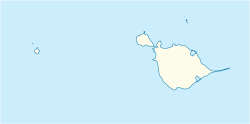
The West Cape ( English for Western Cape ) is a cape on the island of Heard in the southern Indian Ocean . It forms the southern branch of the Laurens Peninsula and marks the entrance to West Bay to the west .
The cape can be found for the first time on a sketch map of the US sealer captain HC Chester from 1860. Scientists from the Australian National Antarctic Research Expeditions carried out surveys in 1948 and named the cape based on the name of the bay of the same name.
Web links
- West Cape in the Geographic Names Information System of the United States Geological Survey (English)
- West Cape on geographic.org (English)
