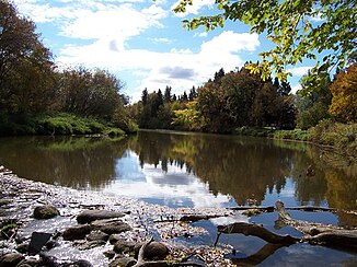
Whitemud River (Lake Manitoba)
| Whitemud River | ||
|
Whitemud River at Westbourne |
||
| Data | ||
| location | Manitoba (Canada) | |
| River system | Nelson River | |
| Drain over | Fairford River → Dauphin River → Nelson River → Hudson Bay | |
| confluence | from Stony Creek and Boggy Creek 50 ° 13 ′ 42 " N , 99 ° 27 ′ 21" W |
|
| Source height | 354 m | |
| muzzle |
Lake Manitoba Coordinates: 50 ° 15 ′ 0 ″ N , 98 ° 35 ′ 0 ″ W 50 ° 15 ′ 0 ″ N , 98 ° 35 ′ 0 ″ W. |
|
| Mouth height | 248 m | |
| Height difference | 106 m | |
| Bottom slope | approx. 0.88 ‰ | |
| length | approx. 120 km | |
| Catchment area | > 6380 km² | |
| Outflow at Westbourne A Eo gauge : 6380 km² |
MQ 1972/2000 Mq 1972/2000 |
5.7 m³ / s 0.9 l / (s km²) |
| Small towns | Gladstone | |
| Communities | Neepawa , Arden , Westbourne | |
The Whitemud River is a tributary of Lake Manitoba in the Canadian province of Manitoba .
The Whitemud River arises at the confluence of Stony Creek and Boggy Creek at Neepawa . From there it flows in an easterly direction. It passes the places Arden , Gladstone and Westbourne and finally flows into Lake Manitoba at Lynchs Point . The Whitemud River has a length of about 120 km. The catchment area covers more than 6380 km². The annual runoff varies greatly. The long-term mean discharge at the gauge at Westbourne is 5.7 m³ / s.
Individual evidence
- ↑ a b Whitemud River at Westbourne gauge - hydrographic data from R-ArcticNET
