Wiedergeltinger grove
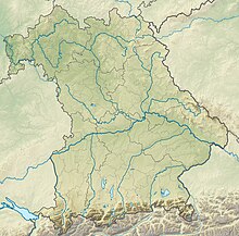
The location of the Wiedergeltinger wood in Bavaria |
The Wiedergeltingen wood , also called Viehweid , is a forest in the municipality of Wiedergeltingen in Bavaria .
location
The Wiedergeltinger wood is located about one kilometer south of Wiedergeltingen. Most of it is in the area of the municipality of Wiedergeltingen in the Unterallgäu district , with only about 10% of the area in the Ostallgäu district . The forest area is traversed by the Hungerbach and thus divided into an east and a west half. In the north, the Wiedergeltinger wood borders directly on the federal motorway 96 . To the south, the forest is delimited by a high-voltage power line . The altitude is about 617 m above sea level. NHN .
history
In the past the forest was used as a so-called Hutewald . Due to the sparse tree population, the forest could be used as pasture for the cattle. The field name Viehweid for the forest area still reminds of this time . As early as the 19th century, the contours of the grove corresponded roughly to today's dimensions. In the course of the use of the forest area and the adjacent fallow and meadow areas as pasture, there were ongoing disputes in the 16th century between the community of Wiedergeltingen on the one hand and the villages of Lindenberg, Jengen, Ketterschwang, Weinhausen, Weicht and Ummenhausen on the other. This dispute was finally settled by a settlement letter of June 12, 1578, in which the grazing rights were delimited from one another locally. In 2000, a large part of the forest was designated as an FFH area .
FFH area
The FFH area within the forest covers an area of 26 hectares, immediately south of the A96. No part of the FFH area is further than 700 m from the edge of the motorway. The habitat type is described as limestone (semi) dry grass and bushes with orchid-rich stands. About 88% of the area is classified in the area data sheet as artificial and coniferous forests . In the sparse pine forest there are scattered remnants of a continental grassland and small-scale meadow grass . Only plants are listed as species worthy of protection, for example the lady's slipper .
Individual evidence
- ↑ Barbara Knoll: Viehweid The natural treasures right on the doorstep. In: local edition online. Augsburger Allgemeine , June 3, 2015, accessed on March 31, 2018 .
- ↑ Federal Agency for Cartography and Geodesy , State Office for Surveying and Geoinformation Bavaria : Digital Topographic Map 1:25 000, [1] , accessed on March 31, 2018
- ↑ Bavarian Surveying Administration : Original position sheets of the Bavarian land survey 1817-1841. In: Position sheet 1: 25,000. Bavarian State Ministry of Finance, State Development and Homeland, 1817, accessed on March 30, 2018 .
- ^ Johann Georg von Lori: The history of Lechrains second volume, containing documents. Munich, 1765, pp. 406f, no. CCCLXXV.
- ^ Allgäuer Zeitung: Protected areas: plans are available. February 25, 2000, accessed March 30, 2018 .
- ↑ BfN: 7930-301 Wiedergeltinger Wäldchen (FFH area). In: Profiles of the Natura 2000 areas. Federal Agency for Nature Conservation, April 15, 2015, accessed on March 30, 2018 .
- ↑ LfU: NATURA 2000 in Bavaria - standard data sheets . (PDF file) In: Data sheet of the Wiedergeltinger wood. Bavarian State Office for the Environment, June 2016, accessed on March 30, 2018 .
Coordinates: 48 ° 1 ′ 25 ″ N , 10 ° 41 ′ 4 ″ E

