Wilson Lake (Kansas)
| Wilson Lake Wilson Dam |
|||||||||
|---|---|---|---|---|---|---|---|---|---|
| Wilson Dam | |||||||||
|
|||||||||
|
|
|||||||||
| Coordinates | 38 ° 56 '49 " N , 98 ° 34' 39" W | ||||||||
| Data on the structure | |||||||||
| Lock type: | Earthfill dam | ||||||||
| Construction time: | 1961-1964 | ||||||||
| Crown length: | 1 720 m | ||||||||
| Operator: | US Army Corps of Engineers, Kansas City District | ||||||||
| Data on the reservoir | |||||||||
| Altitude (at congestion destination ) | 462 m | ||||||||
| Water surface | 36.58 km² | ||||||||
| Reservoir length | 19.4 km | ||||||||
| Reservoir width | 2.1 km | ||||||||
| Maximum depth | 20 m | ||||||||
| Storage space | 299 million m³ | ||||||||
| Catchment area | 4th 965 km² | ||||||||
The Wilson Lake (also Wilson Reservoir called) in the US state of Kansas is a reservoir km² with an area of 36.58.
location
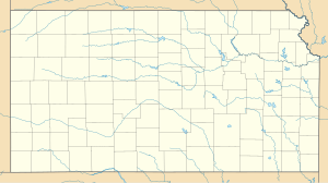
The Wilson Dam ( ⊙ ) is located in Russell County and Lincoln Counties on the Saline River and was approved for construction by the Kansas Bureau of Reclamation in 1964 for flood protection purposes . The catchment area of the reservoir is 4965 km². The storage capacity with a full jam is 299 million m³.
Others
There are five local recreation areas or parks in the vicinity of the reservoir. These are: Lucas , Minooka , Sylvan Parks , Wilson State Park, and Otoe State Park .
The lake is popular with many anglers because of the large number of fish species, some of which are unique to the region. These include the bluegills - sunfish that were speckled fork catfish , the White crappies (Bar Chart), the flathead catfish (Katzenwelsart), the largemouth bass , the black bass , the dotted grouper ( Spotted bass ), the striped bass , the American Zander ( Walleye ) and White perch .
Web links
- Wilson Lake in the United States Geological Survey's Geographic Names Information System
- US Army Corps of Engineers, Kansas City District: Wilson Lake
- wilsonks.com
- Wilson Lake Yield Analysis Report / Kansas Water Office (PDF file; 663 kB)
Individual evidence
- ↑ Wilson Lake, Kansas (PDF, 1.8 MB) US Army Corps of Engineers, Kansas City District. Retrieved December 8, 2017.

