Woolacombe
Coordinates: 51 ° 10 ′ N , 4 ° 12 ′ W
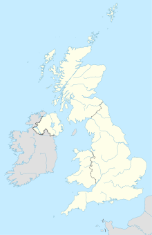
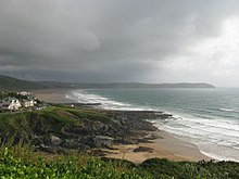
Woolacombe is a seaside resort of approx. 1000 inhabitants with an almost 6 km long sandy beach on the north coast of the English county of Devon, southwest of Ilfracombe between Mortehoe and Saunton .
Geography and landscape
The place lies in a wide valley cut between the treacherous rocks of Morte Point , which have been the fate of castaways since the Middle Ages, in the north and the cliff peninsula Baggy Point in the south.
The coastal landscape around Mortehoe and Woolacombe was bequeathed to the National Trust by Rosalie Chichester in 1949 . The British environmental agency Natural England , established in 2006, has a special protection as an Area of Outstanding Natural Beauty .
Behind the beaches are the dunes of the Woolacombe Warren and extensive heather areas; This links country had an 18-hole golf course before the Second World War. Behind the links there are sheep pastures separated from each other by high hedges.
Woolacombe has a total of three beaches:
- The approximately 5 km long main beach Woolacombe Sands , which is so popular in the main season that the parking capacity of the place is regularly overloaded;
- the small, quiet sandy bays Barricane Beach and Coombesgate Beach north of the village between rocks with rock pools for bathing at low tide;
- the Putsborough Sands west of the Woolacombe Sands, which are mainly used by surfers; the beach stretches to below the baggy point , where seals can often be found.
history
In the Domesday Book the valley cut is mentioned as Wolnecoma (presumably " Wolf Valley"); there is no mention of a settlement.
No more than one farm belonging to the parish of Mortehoe is documented in the 19th century.
The mouth of the valley only developed into a holiday resort with the connection of Mortehoe to the railway line from Ilfracombe to Barnstaple ( Ilfracombe Branch Line ) built in 1874 ; although the train station was nearly 4 km from both Mortehoe center and Woolacombe Sands , this made the area much easier for guests to access than before.
Weekend family accommodations, utilities, pubs, shops, and sports facilities emerged.
During World War II, Woolacombe was a training camp for US troops for D-Day . For this purpose, the golf course in the Woolacombe Warrens had to be abandoned.
Tourism revitalized in the middle of the 20th century. New hotels, bed and breakfasts , a campsite, several surf schools, a riding stables and a lane golf course ( crazy golf course ) were built.
Infrastructure, tourism, sport
The Ilfracombe Branch Line railway was closed in 1970; Until 2005, the train station housed the Once Upon a Time children's amusement park .
For motor vehicle traffic, Woolacombe is connected to North Devon's urban centers of Ilfracombe, Braunton and Barnstaple by the B 3343 . There is also a bus connection to which Mortehoe is connected via a single-lane branch line.
The South West Coast Path runs through the village - below the Esplanade - the longest marked long-distance footpath in Great Britain at 1014 km; this coincides with the Tarka Trail , another approx. 290 km long long distance footpath through Devon's inland, moors and coastlines with the logo of the animal protagonist in the novel by Henry Williamson .
Even trail riding in the area of Woolacombe Sands is possible.
Web links
swell
- Mortehoe & Woolacombe Walking Map 1: 12,500, Croydecycle 2009
- North Devon Coast Areas of Outstanding Natural Beauty AONB Landscape North Devon
- Tourist information
- Tales of Woolacombe at War War Experiences (BBC research)

