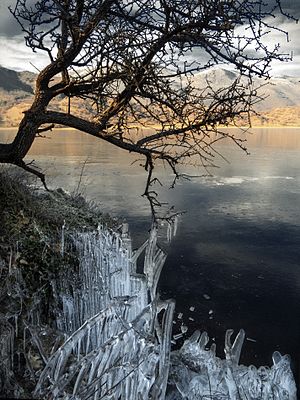
Zazari lake
|
Zazari Lake Ζάζαρη (Greek) |
||
|---|---|---|

|
||
| Geographical location | West Macedonia , Greece | |
| Tributaries | Clithros | |
| Drain | to Chimaditida Lake | |
| Data | ||
| Coordinates | 40 ° 37 '45 " N , 21 ° 32' 59" E | |
|
|
||
| Altitude above sea level | 602 m | |
| surface | 1.85 km² | |
| length | 2 km | |
| width | 1.4 km | |
| Middle deep | 4.6 m | |
The Zazari Lake ( Greek Ζάζαρη , f. Sg.) Is a small lake in the north of Greece, in the eastern part of the Regional District Florina located. It belongs to a series of lakes in the Eordea Basin (λεκάνης της Εορδαίας) formed by the Verno , Voras , Siniatsiko and Vermio mountains . Apart from Lake Zazari, Lake Vegoritida , Lake Chimaditida (Χειμαδίτιδα) and Lake Petres belong to this group of lakes.
geography
The Zazari lake has an area of approx. 2 km² and lies at 602 m above sea level . The mean depth is 4.6 m. It is fed by the small river Sklithros, which rises in Verno. Lake Zazari itself gives off water to the Chimatidida . The lake was included in the Natura 2000 program together with its neighbors, and it bears the number GR 1340005.
Web links
Commons : Lake Zazari - Collection of pictures, videos and audio files
- Galateias Kozanis high school: the lakes Chimatidida and Zazari (Greek)
- Valtonero Florinas
- ΕΟΒ Vitsiu
Individual evidence
- ↑ a b c d Information about the lakes on the homepage of a high school
- ↑ Page no longer available , search in web archives: ΕΟΒ Βιτσίου, οι λίμνες Χειμαδίτιδα και Ζάζαρη
